MyTopo
Elgin SW Nevada US Topo Map
Couldn't load pickup availability
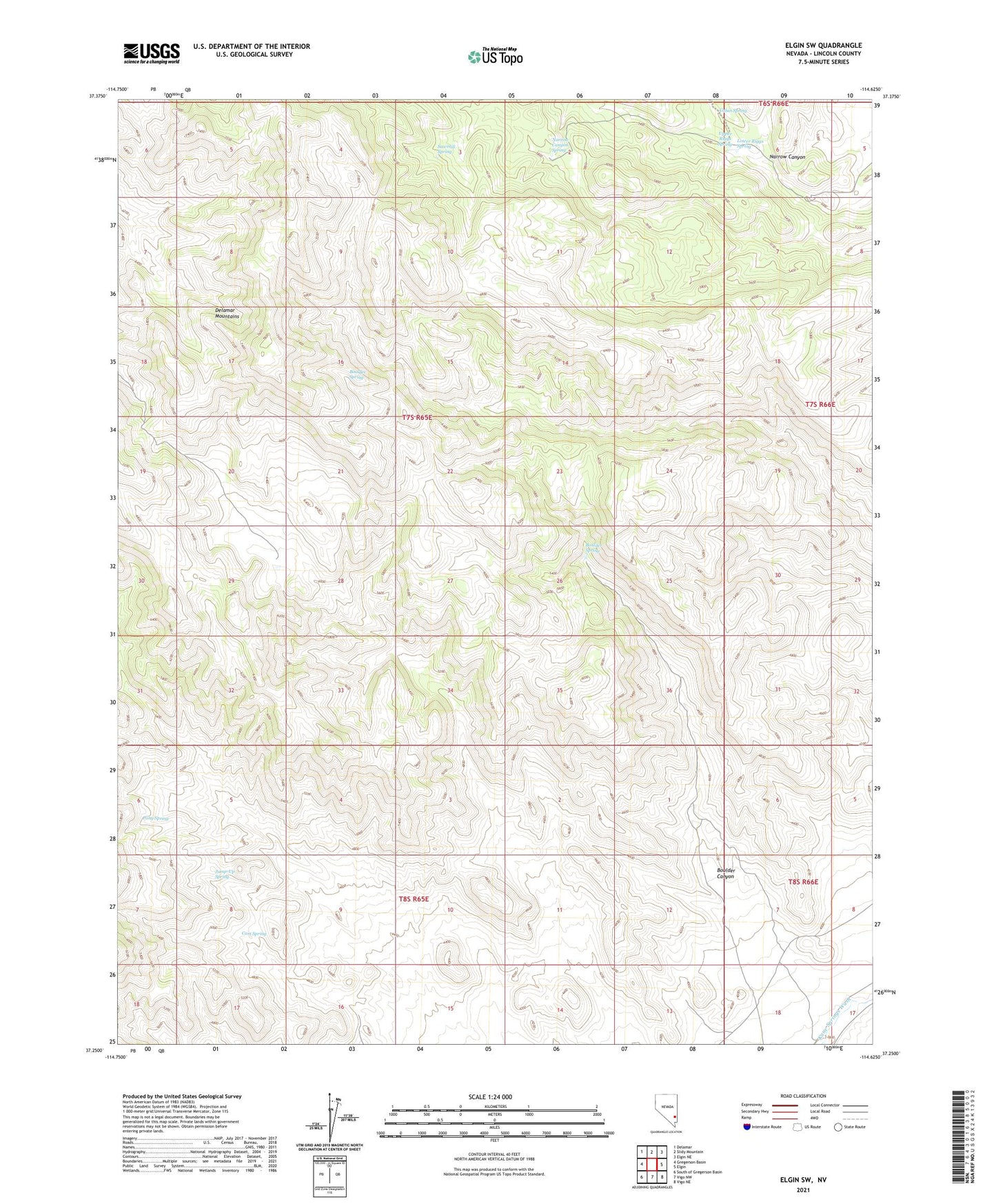
2021 topographic map quadrangle Elgin SW in the state of Nevada. Scale: 1:24000. Based on the newly updated USGS 7.5' US Topo map series, this map is in the following counties: Lincoln. The map contains contour data, water features, and other items you are used to seeing on USGS maps, but also has updated roads and other features. This is the next generation of topographic maps. Printed on high-quality waterproof paper with UV fade-resistant inks.
Quads adjacent to this one:
West: Gregerson Basin
Northwest: Delamar
North: Slidy Mountain
Northeast: Elgin NE
East: Elgin
Southeast: Vigo NE
South: Vigo NW
Southwest: South of Gregerson Basin
This map covers the same area as the classic USGS quad with code o37114c6.
Contains the following named places: Boulder Canyon, Boulder Spring, Cabin Spring, Cart Spring, Jump-Up Spring, Lower Riggs Spring, Narrow Canyon, Narrow Canyon Spring, Pony Spring, Sawmill Spring, Upper Riggs Spring