MyTopo
Fencemaker Pass Nevada US Topo Map
Couldn't load pickup availability
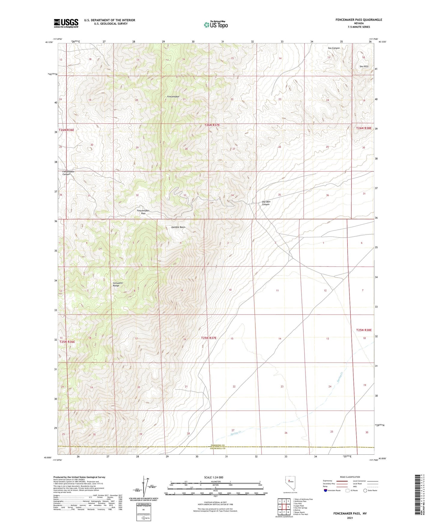
2021 topographic map quadrangle Fencemaker Pass in the state of Nevada. Scale: 1:24000. Based on the newly updated USGS 7.5' US Topo map series, this map is in the following counties: Pershing, Churchill. The map contains contour data, water features, and other items you are used to seeing on USGS maps, but also has updated roads and other features. This is the next generation of topographic maps. Printed on high-quality waterproof paper with UV fade-resistant inks.
Quads adjacent to this one:
West: Logan Peak
Northwest: West of McKinney Pass
North: McKinney Pass
Northeast: Sou Hills
East: Sou Hot Springs
Southeast: Hole In The Wall
South: Boyer Ranch
Southwest: Bolivia
Contains the following named places: Fencemaker, Fencemaker Canyon, Fencemaker Mine, Fencemaker Pass, Gamble Basin, Gilberts Mine, Old Man Canyon, Susie Mine