MyTopo
Sou Hot Springs Nevada US Topo Map
Couldn't load pickup availability
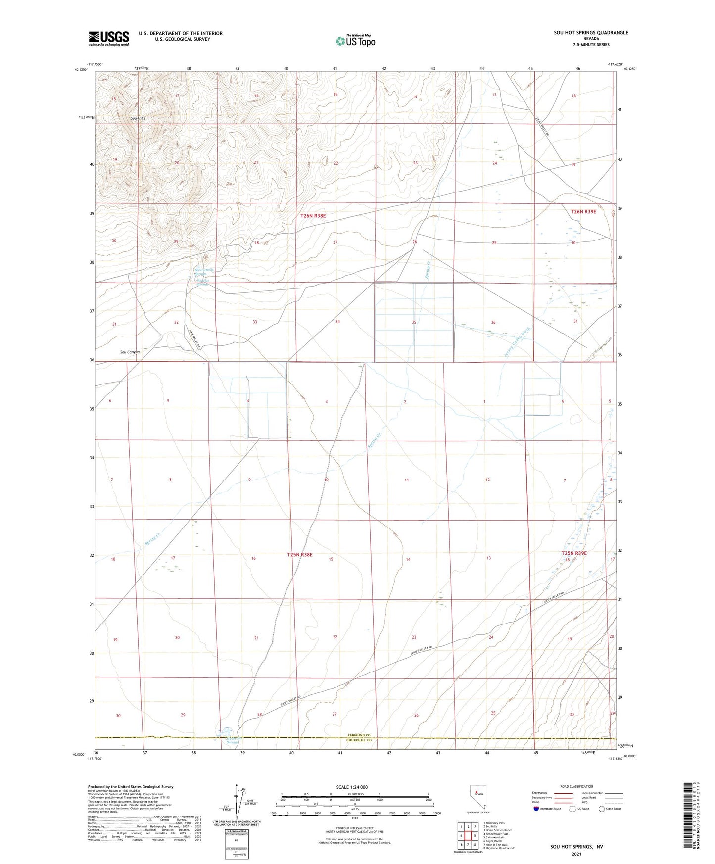
2023 topographic map quadrangle Sou Hot Springs in the state of Nevada. Scale: 1:24000. Based on the newly updated USGS 7.5' US Topo map series, this map is in the following counties: Pershing, Churchill. The map contains contour data, water features, and other items you are used to seeing on USGS maps, but also has updated roads and other features. This is the next generation of topographic maps. Printed on high-quality waterproof paper with UV fade-resistant inks.
Quads adjacent to this one:
West: Fencemaker Pass
Northwest: McKinney Pass
North: Sou Hills
Northeast: Home Station Ranch
East: Cain Mountain
Southeast: Shoshone Meadows NE
South: Hole In The Wall
Southwest: Boyer Ranch
This map covers the same area as the classic USGS quad with code o40117a6.
Contains the following named places: Hyder Hot Springs, Jersey Valley Wash, Little McCoy Ranch, Seven Devils Ranch, Seven Devils Springs, Sou Canyon, Sou Hot Springs