MyTopo
Fife Mountain Nevada US Topo Map
Couldn't load pickup availability
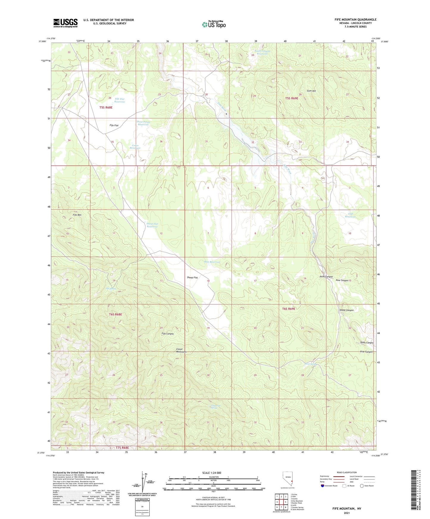
2021 topographic map quadrangle Fife Mountain in the state of Nevada. Scale: 1:24000. Based on the newly updated USGS 7.5' US Topo map series, this map is in the following counties: Lincoln. The map contains contour data, water features, and other items you are used to seeing on USGS maps, but also has updated roads and other features. This is the next generation of topographic maps. Printed on high-quality waterproof paper with UV fade-resistant inks.
Quads adjacent to this one:
West: Ella Mountain
Northwest: Eccles
North: Islen
Northeast: Acoma
East: Bunker Peak
Southeast: Jacks Mountain
South: Garden Spring
Southwest: Leith
This map covers the same area as the classic USGS quad with code o37114d3.
Contains the following named places: Cedar Reservoir, Cliff Reservoir, Clover Mountains, Fife Flat, Fife Flat Reservoir, Fife Mountain, Fife Spring, Grapevine Spring, Gum Hill, Jacks Canyon, Mag Reservoir, Pine Canyon, Pine Canyon Dam, Pine Canyon Reservoir, Pine Wash Well, Sheep Canyon, Sheep Flat, Sheep Flat Reservoir, Sheep Spring, South Canyon Reservoir, Tanks Canyon, Three Points Reservoir