MyTopo
Bunker Peak Nevada US Topo Map
Couldn't load pickup availability
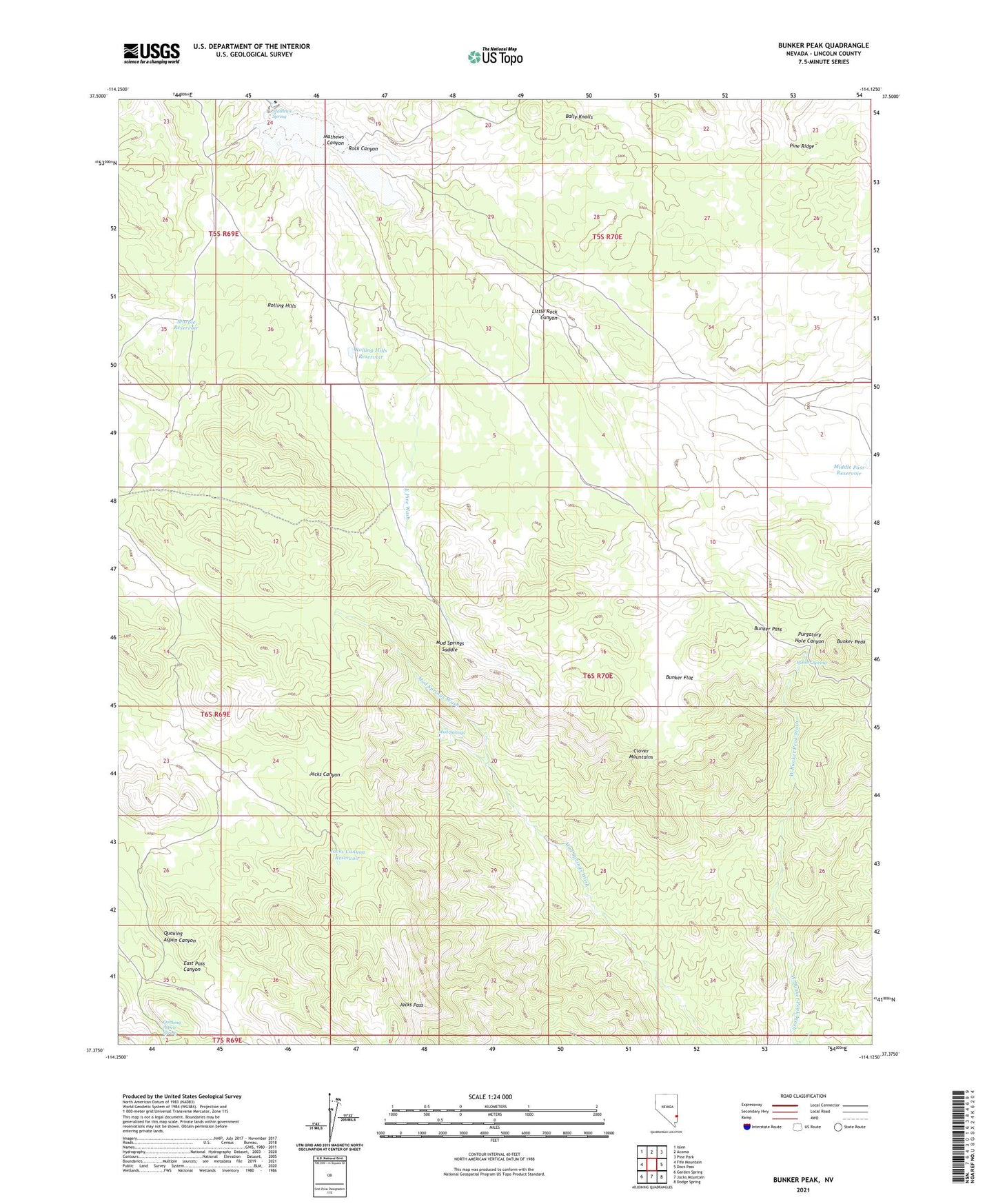
2021 topographic map quadrangle Bunker Peak in the state of Nevada. Scale: 1:24000. Based on the newly updated USGS 7.5' US Topo map series, this map is in the following counties: Lincoln. The map contains contour data, water features, and other items you are used to seeing on USGS maps, but also has updated roads and other features. This is the next generation of topographic maps. Printed on high-quality waterproof paper with UV fade-resistant inks.
Quads adjacent to this one:
West: Fife Mountain
Northwest: Islen
North: Acoma
Northeast: Pine Park
East: Docs Pass
Southeast: Dodge Spring
South: Jacks Mountain
Southwest: Garden Spring
This map covers the same area as the classic USGS quad with code o37114d2.
Contains the following named places: Barclay Well, Bunker Flat, Bunker Pass, Bunker Peak, Bunker Spring, Crow Corral, East Pass Canyon, East Pine Wash, Jacks Canyon Reservoir, Jacks Pass, Little Rock Canyon, Mahogany Knoll Reservoir, Marble Reservoir, Mathews Canyon Dam, Mathews Canyon Reservoir, Mathews Spring, Middle Pass Reservoir, Mud Springs, Mud Springs Saddle, Quaking Aspen Canyon, Quaking Aspen Spring, Rock Canyon, Rock Canyon Well, Rolling Hills, Rolling Hills Reservoir, Wood Ranch