MyTopo
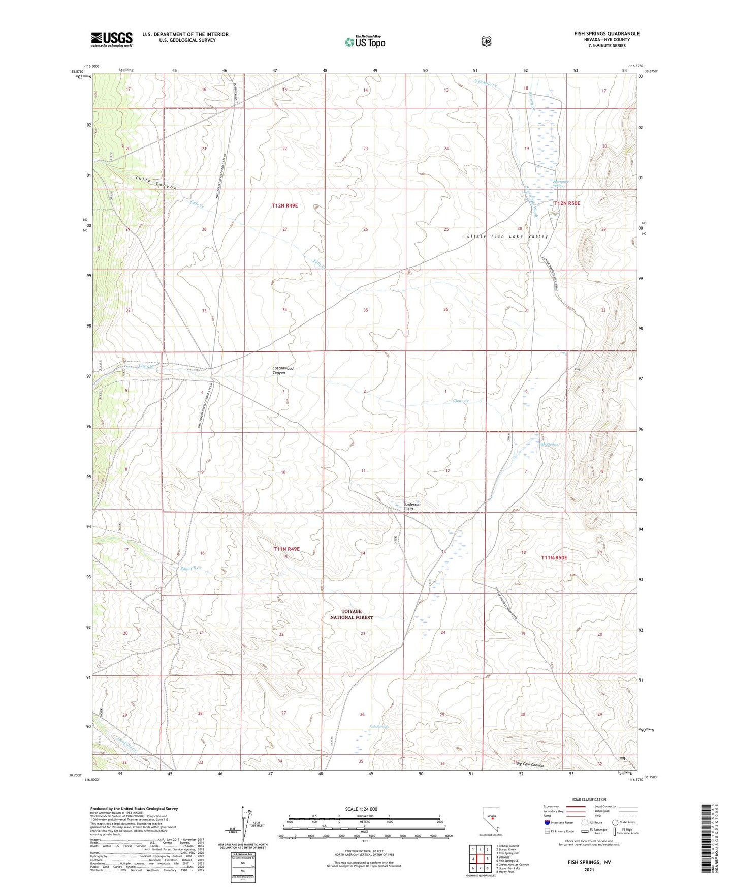
Fish Springs Nevada US Topo Map
Couldn't load pickup availability
Also explore the Fish Springs Forest Service Topo of this same quad for updated USFS data
2021 topographic map quadrangle Fish Springs in the state of Nevada. Scale: 1:24000. Based on the newly updated USGS 7.5' US Topo map series, this map is in the following counties: Nye. The map contains contour data, water features, and other items you are used to seeing on USGS maps, but also has updated roads and other features. This is the next generation of topographic maps. Printed on high-quality waterproof paper with UV fade-resistant inks.
Quads adjacent to this one:
West: Danville
Northwest: Dobbin Summit
North: Stargo Creek
Northeast: Fish Springs NE
East: Fish Springs SE
Southeast: Morey Peak
South: Upper Fish Lake
Southwest: Green Monster Canyon
This map covers the same area as the classic USGS quad with code o38116g4.
Contains the following named places: Anderson Field, Antelope, Antelope Post Office, Big Cow Canyon, Clear Creek, Clear Creek Ranch, Cottonwood Canyon, East Dobbin Creek, Fish Springs, Savory Creek, Sawmill Creek, Seven Mile Spring Corral, Sevenmile Spring, Sevenmile Wash, Stargo Creek, Tulle Canyon, Tulle Creek