MyTopo
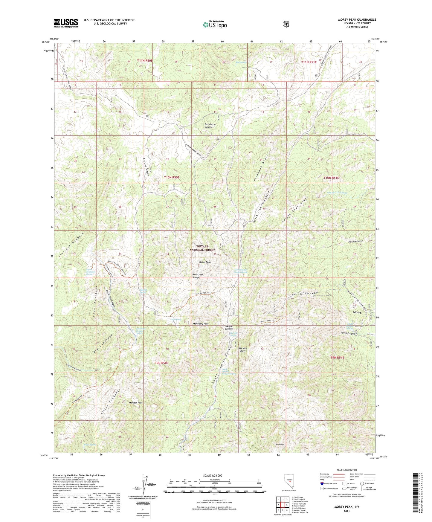
Morey Peak Nevada US Topo Map
Couldn't load pickup availability
Also explore the Morey Peak Forest Service Topo of this same quad for updated USFS data
2021 topographic map quadrangle Morey Peak in the state of Nevada. Scale: 1:24000. Based on the newly updated USGS 7.5' US Topo map series, this map is in the following counties: Nye. The map contains contour data, water features, and other items you are used to seeing on USGS maps, but also has updated roads and other features. This is the next generation of topographic maps. Printed on high-quality waterproof paper with UV fade-resistant inks.
Quads adjacent to this one:
West: Upper Fish Lake
Northwest: Fish Springs
North: Fish Springs SE
Northeast: Pritchards Station
East: Moores Station
Southeast: Moores Station SW
South: Hobble Canyon
Southwest: Little Fish Lake
This map covers the same area as the classic USGS quad with code o38116f3.
Contains the following named places: American Eagle Mine, Aspen Peak, Bay State Mill, Bay State Mine, Big Fandango, Black Diamond Mill, Black Hawk Mine, Cedar Mine, Cold Spring, Devils Cave Ridge, Fishhook Ridge, Kaiser Tunnel, Little Cow Canyon Spring, Little Fandango, Lower Fandango, Lower Fandango Spring, Magnolia Mine, Mahogany Peak, Monitor Peak, Morey, Morey Canyon, Morey Mine, Morey Mining District, Morey Peak, Morey Post Office, Mount Airy Mine, North Sixmile Canyon, North Sixmile Canyon Spring, Point of Rocks Mine, Red Spring, Sidehill Spring, Six Mile Bluff, Six Mile Spring, Sixmile Summit, South Canyon Spring, South Sixmile Canyon Spring, Sweet Spring, Tod Wattle Summit, Topside Mine, Wist Mine