MyTopo
Gardnerville Nevada US Topo Map
Couldn't load pickup availability
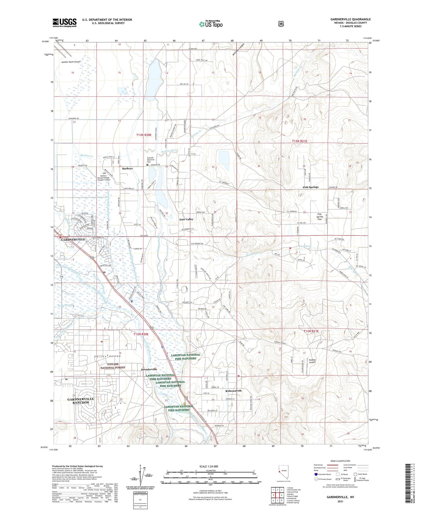
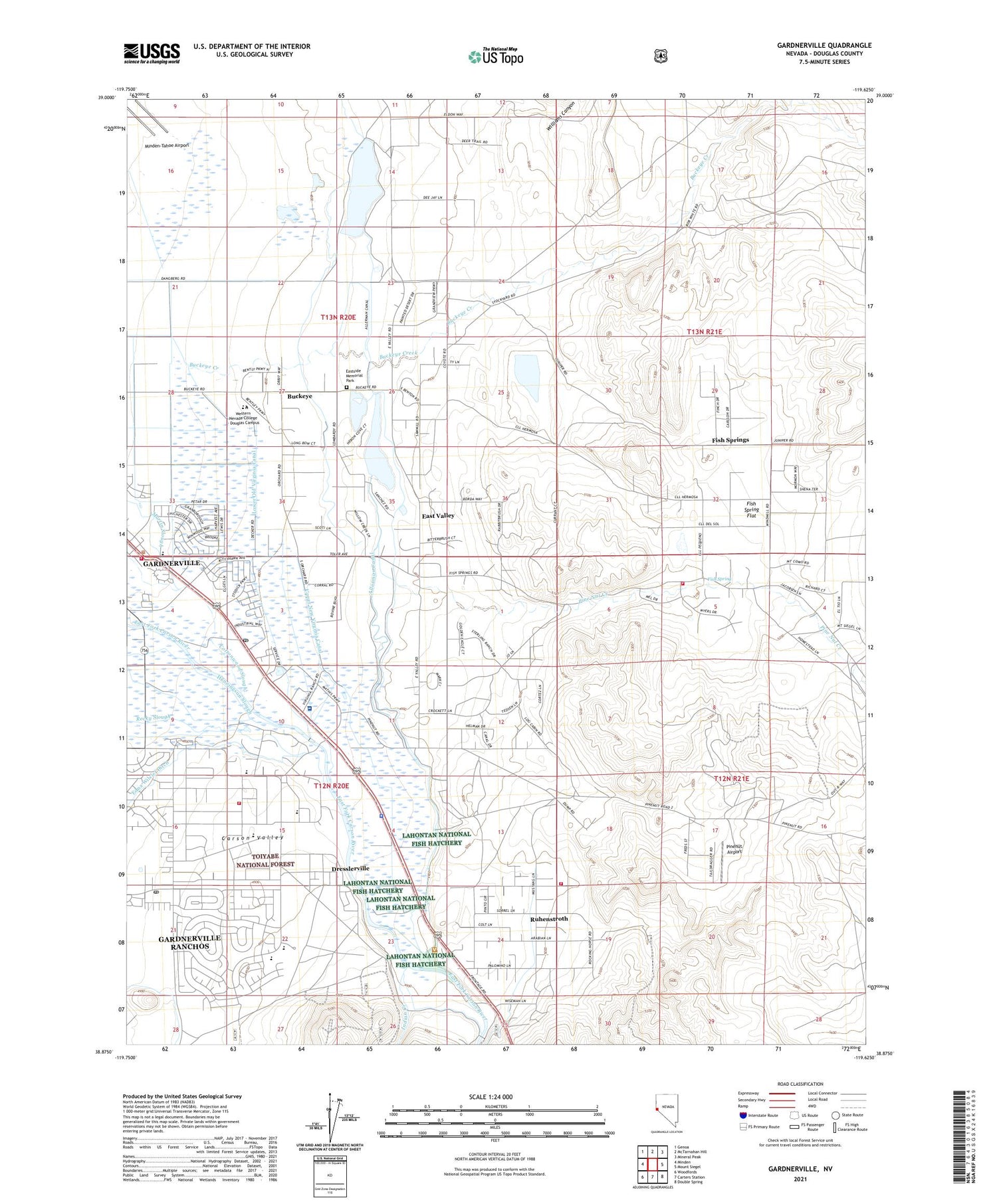
2021 topographic map quadrangle Gardnerville in the state of Nevada. Scale: 1:24000. Based on the newly updated USGS 7.5' US Topo map series, this map is in the following counties: Douglas. The map contains contour data, water features, and other items you are used to seeing on USGS maps, but also has updated roads and other features. This is the next generation of topographic maps. Printed on high-quality waterproof paper with UV fade-resistant inks.
Quads adjacent to this one:
West: Minden
Northwest: Genoa
North: McTarnahan Hill
Northeast: Mineral Peak
East: Mount Siegel
Southeast: Double Spring
South: Carters Station
Southwest: Woodfords
Contains the following named places: Allens Bridge, Allerman Canal, Behrman Ranch, Buckeye, Buckeye Creek, Buckeye Creek Well, C C Meneley Elementary School, Calvary Chapel Carson Valley Faith Christian Academy, Carson Valley Medical Center, Crossroads Learning Center, Dangberg Dam Number Four, Dangberg Dam Number Three, Dangberg Reservoir Number Four, Dangberg Reservoir Number Three, Desert Station, Dresslerville, Dresslerville Colony, Dresslerville Water Tank, East Fork Fire and Paramedic Districts Station 10, East Fork Fire and Paramedic Districts Station 2 Gardnerville Volunteer Fire Department, East Fork Fire and Paramedic Districts Station 7 Gardnerville Ranchos Volunteer Fire Department, East Fork Fire and Paramedic Districts Station 9 Fish Springs Volunteer Fire Department, East Fork Township, East Valley Census Designated Place, Eastside Memorial Park, Edna Wilslef Ditch, Fish Creek Well, Fish Spring, Fish Spring Flat, Fish Springs Census Designated Place, Fletcher Ranch, Gardnerville, Gardnerville Census Designated Place, Gardnerville Elementary School, Gardnerville Post Office, Gardnerville Ranchos, Gardnerville Ranchos Census Designated Place, Gardnerville-Minden Division, Gene Scarselli Elementary School, Heidtman Ranch, Hussman Ranch, Lahontan National Fish Hatchery, Lampe Park, Lower Old Virginia Canal, Old Virginia Canal, Pau - Wa - Lu Middle School, Pine Nut Creek, Pinenut Airport, Ranchos Post Office, Ruhenstroth Census Designated Place, Ruhenstroth Well, Settlemeyer Ranch, Springmeyer Ranch, Tisdells, Twelve Mile House Post Office, Twelvemile House, Upper New Virginia Canal, Washoe Tribe Campground, Washoe Tribe Police Department, Wehrman Ranch, Williams Canyon, Wilslef Brothers Ranch, Xebec Industrial Park Heliport