MyTopo
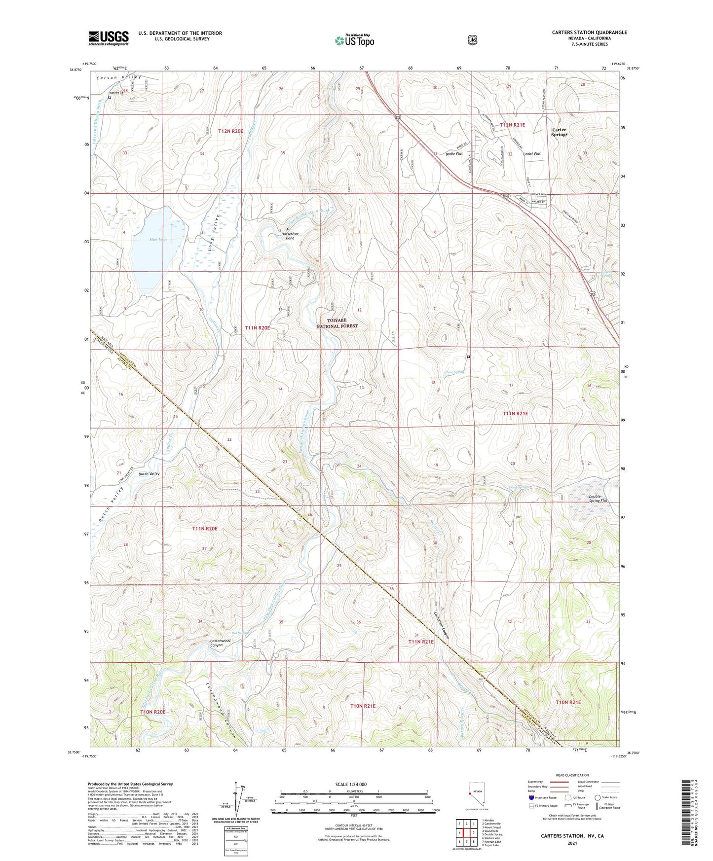
Carters Station Nevada US Topo Map
Couldn't load pickup availability
Also explore the Carters Station Forest Service Topo of this same quad for updated USFS data
2021 topographic map quadrangle Carters Station in the states of Nevada, California. Scale: 1:24000. Based on the newly updated USGS 7.5' US Topo map series, this map is in the following counties: Douglas, Alpine. The map contains contour data, water features, and other items you are used to seeing on USGS maps, but also has updated roads and other features. This is the next generation of topographic maps. Printed on high-quality waterproof paper with UV fade-resistant inks.
Quads adjacent to this one:
West: Woodfords
Northwest: Minden
North: Gardnerville
Northeast: Mount Siegel
East: Double Spring
Southeast: Topaz Lake
South: Heenan Lake
Southwest: Markleeville
This map covers the same area as the classic USGS quad with code o38119g6.
Contains the following named places: Barney Riley, Barney Riley Creek, Bodie Flat, Bryant Creek, Carter Springs Census Designated Place, Carters Springs, Carters Station, Cedar Flat, China Spring, China Spring Youth Camp, Cottonwood Canyon, Doud Springs, Dutch Valley, Falke and Tillman Ditch, Horse Shoe Bend Dam Site, Horseshoe Bend, Hot Springs, Indian Valley Ranch, Leviathan Canyon, Long Valley, Mud Lake, Nevada Tungsten Mill, Pinyon Dam Site, River Ranch, Stoddard and Jewel Jacobsen High School, Uhalde Springmeyer Stock Bridge, Washoe Cemetery, Youngs Crossing