MyTopo
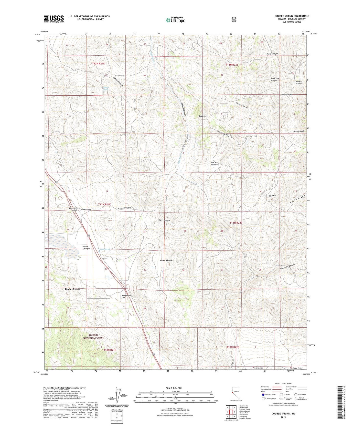
Double Spring Nevada US Topo Map
Couldn't load pickup availability
Also explore the Double Spring Forest Service Topo of this same quad for updated USFS data
2021 topographic map quadrangle Double Spring in the state of Nevada. Scale: 1:24000. Based on the newly updated USGS 7.5' US Topo map series, this map is in the following counties: Douglas. The map contains contour data, water features, and other items you are used to seeing on USGS maps, but also has updated roads and other features. This is the next generation of topographic maps. Printed on high-quality waterproof paper with UV fade-resistant inks.
Quads adjacent to this one:
West: Carters Station
Northwest: Gardnerville
North: Mount Siegel
Northeast: Pine Nut Valley
East: Oreana Peak
Southeast: Long Dry Canyon
South: Topaz Lake
Southwest: Heenan Lake
This map covers the same area as the classic USGS quad with code o38119g5.
Contains the following named places: Alpine Mill, Alpine Mine, B and C Tungsten Mine, Bald Mountain, Bells Ranch, Blossom Canyon, Boyd Ranch, Brown Meadows, Buffalo Canyon, Buffalo Spring, Bullionville, Carman Heights, Carson Valley Tungsten Mine, Carter Canyon, Danite Mine, Dead Horse Flat, Double Spring, Double Spring Census Designated Place, Double Spring Flat, Double Springs, Duval Mine, Galena Summit, Gold Bug Mine, Granite Peak, Knox and Nixon Shaft, Little Comstock Mine, Longfellow Mine, Mammoth Ledge, Mammoth Ledge Post Office, Mammoth Mine, Mill Canyon, Minnehaha Canyon, Monitor Mine, Mountain House Mining District, Nevada Tungsten Mine, Orpheus Mine, Payday Tunnel, Pikes Peak Mine, Pine Nut Consolidated Mine, Pratts Quartz Mill, Preachers Mine, Premier Mine, Rattlesnake Hill, Red Canyon Mining District, Red Cloud Shaft, Ruby Hill Mine, Simee Dimeh Summit, Sprague Post Office, Sugar Loaf, Thompson Canyon, Tungsten Mine, Ventura Mine, Veta Grande Mine, Washoe Ranches Trust Land, Water Canyon, ZIP Code: 89410