MyTopo
Grassy Mountain Nevada US Topo Map
Couldn't load pickup availability
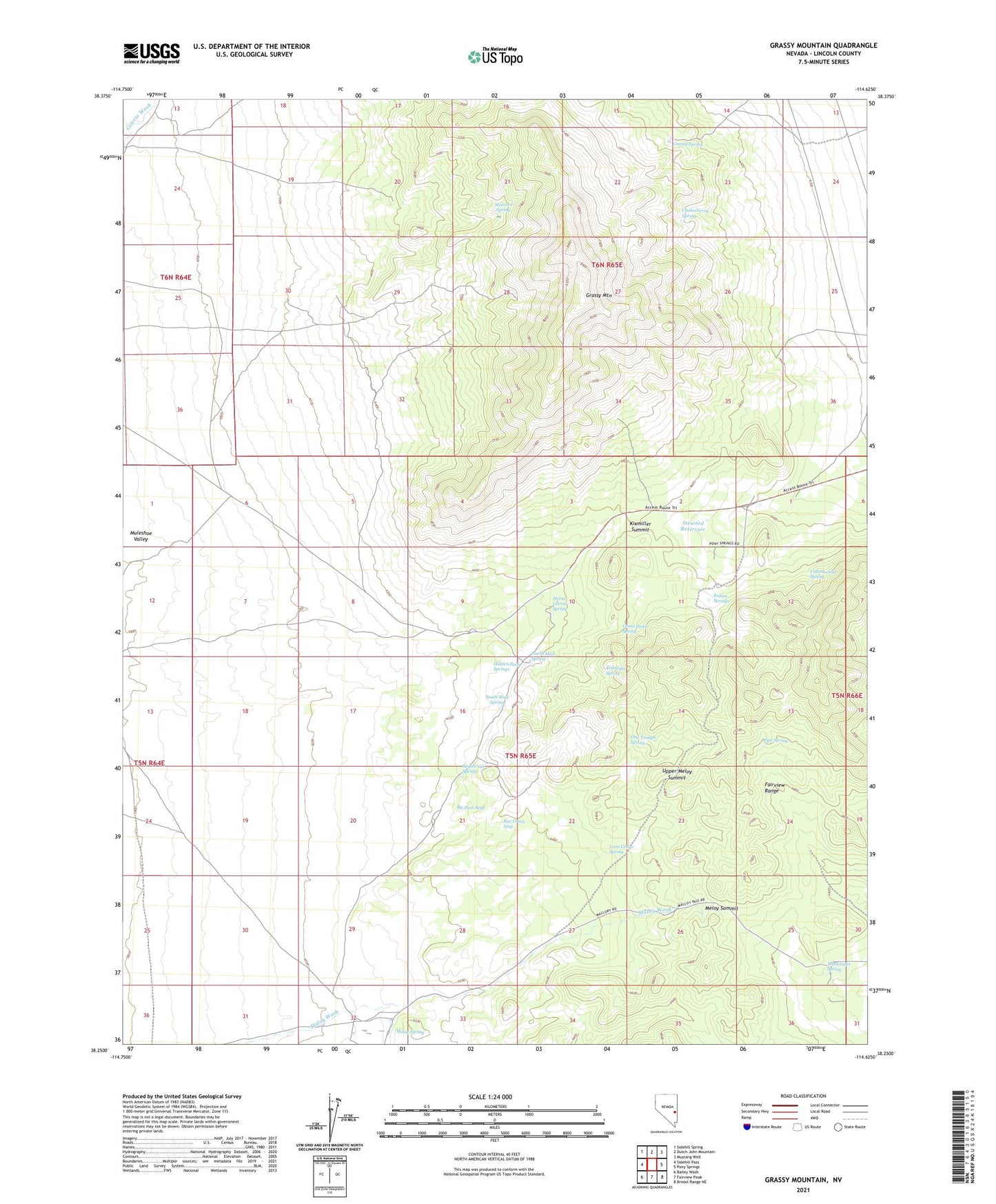
2021 topographic map quadrangle Grassy Mountain in the state of Nevada. Scale: 1:24000. Based on the newly updated USGS 7.5' US Topo map series, this map is in the following counties: Lincoln. The map contains contour data, water features, and other items you are used to seeing on USGS maps, but also has updated roads and other features. This is the next generation of topographic maps. Printed on high-quality waterproof paper with UV fade-resistant inks.
Quads adjacent to this one:
West: Sidehill Pass
Northwest: Sidehill Spring
North: Dutch John Mountain
Northeast: Mustang Well
East: Pony Springs
Southeast: Bristol Range NE
South: Fairview Peak
Southwest: Bailey Wash
This map covers the same area as the classic USGS quad with code o38114c6.
Contains the following named places: By-Pass Seep, Chokecherry Spring, Cottonwood Spring, Grass Patch Spring, Grassy Mountain, Grassy Spring, Hidden Seep Springs, Horse Corral Spring, Indian Springs, Kixmiller Summit, Lone Cedar Spring, McDermitt Spring, Meloy Ranch, Meloy Spring, Meloy Summit, North Mud Spring, One Trough Spring, Pipe Spring, Rye Grass Seep, Sagebrush Spring, South Mud Spring, Steward Ranch, Steward Reservoir, Steward Spring, Tribolata Spring, Upper Meloy Summit