MyTopo
Bristol Range NE Nevada US Topo Map
Couldn't load pickup availability
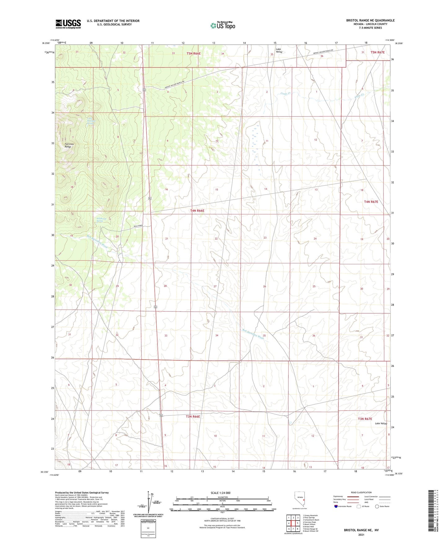
2021 topographic map quadrangle Bristol Range NE in the state of Nevada. Scale: 1:24000. Based on the newly updated USGS 7.5' US Topo map series, this map is in the following counties: Lincoln. The map contains contour data, water features, and other items you are used to seeing on USGS maps, but also has updated roads and other features. This is the next generation of topographic maps. Printed on high-quality waterproof paper with UV fade-resistant inks.
Quads adjacent to this one:
West: Fairview Peak
Northwest: Grassy Mountain
North: Pony Springs
Northeast: Schoolmarm Basin
East: Mount Wilson
Southeast: Mount Wilson SW
South: Bristol Range SE
Southwest: Bristol Well
This map covers the same area as the classic USGS quad with code o38114b5.
Contains the following named places: Bob Hamilton Wash, Craw Creek, Craw Creek Well, Dodge Well, Little Rosebud Spring, Pioche Division, Twenty One Mile House, Twentyonemile Well, Wildhorse Spring