MyTopo
Hat Peak Nevada US Topo Map
Couldn't load pickup availability
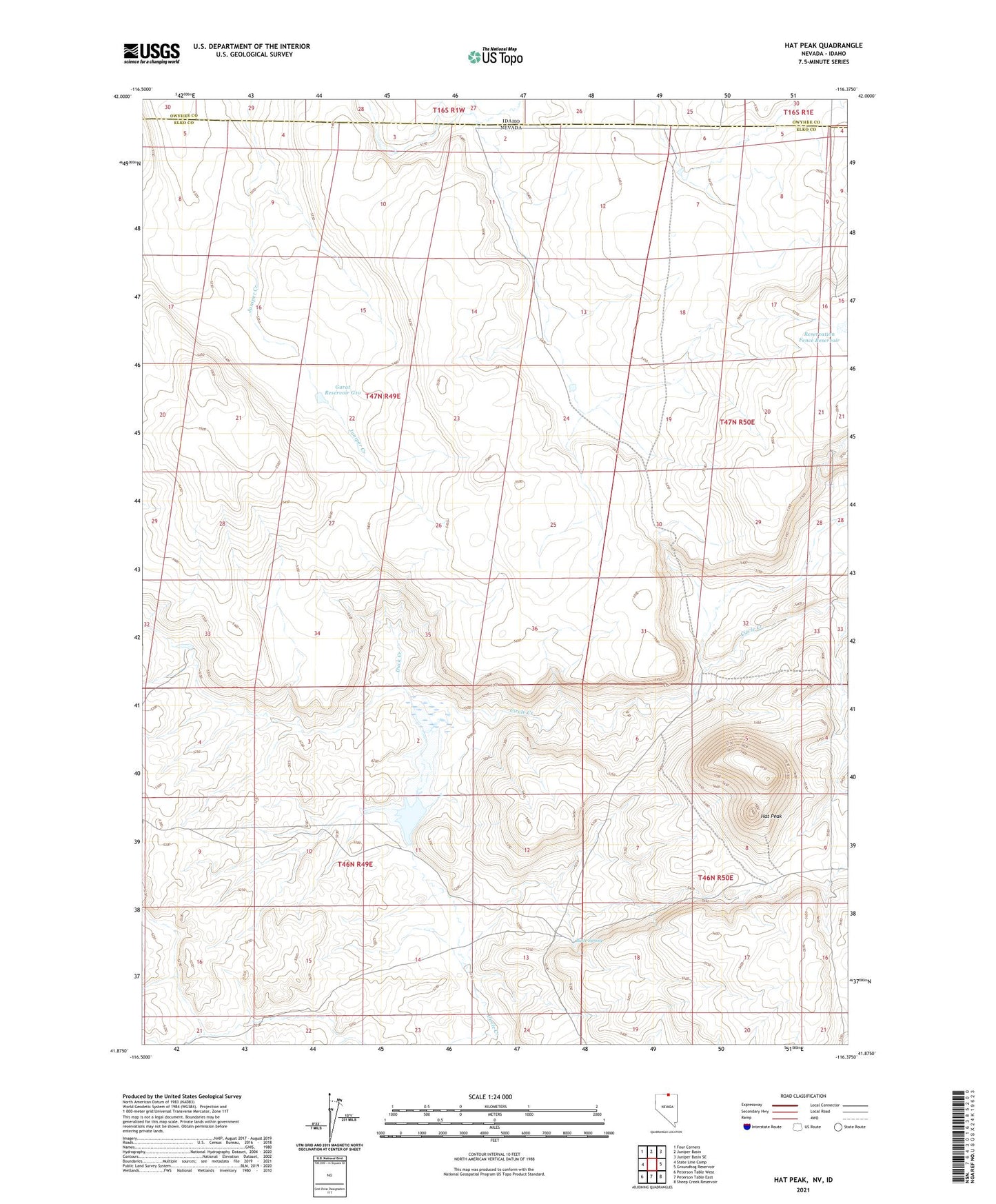
2021 topographic map quadrangle Hat Peak in the state of Nevada. Scale: 1:24000. Based on the newly updated USGS 7.5' US Topo map series, this map is in the following counties: Elko, Owyhee. The map contains contour data, water features, and other items you are used to seeing on USGS maps, but also has updated roads and other features. This is the next generation of topographic maps. Printed on high-quality waterproof paper with UV fade-resistant inks.
Quads adjacent to this one:
West: State Line Camp
Northwest: Four Corners
North: Juniper Basin
Northeast: Juniper Basin SE
East: Groundhog Reservoir
Southeast: Sheep Creek Reservoir
South: Peterson Table East
Southwest: Peterson Table West
This map covers the same area as the classic USGS quad with code o41116h4.
Contains the following named places: Butte Spring, Duck Creek, Garat Reservoir G10, Hat Peak, Josephine Reservoir, Josephine Reservoir Dam, Reservation Fence Reservoir