MyTopo
Groundhog Reservoir Nevada US Topo Map
Couldn't load pickup availability
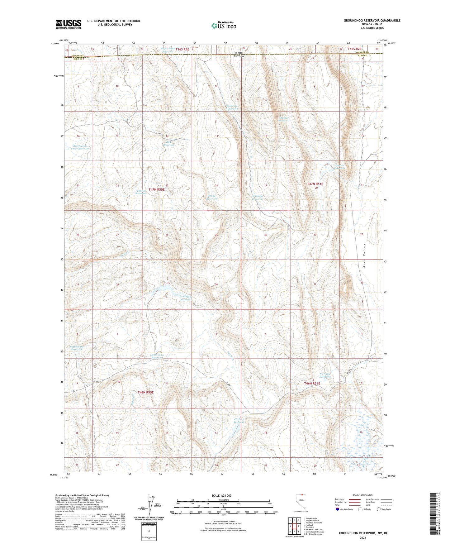
2021 topographic map quadrangle Groundhog Reservoir in the states of Idaho, Nevada. Scale: 1:24000. Based on the newly updated USGS 7.5' US Topo map series, this map is in the following counties: Elko, Owyhee. The map contains contour data, water features, and other items you are used to seeing on USGS maps, but also has updated roads and other features. This is the next generation of topographic maps. Printed on high-quality waterproof paper with UV fade-resistant inks.
Quads adjacent to this one:
West: Hat Peak
Northwest: Juniper Basin
North: Juniper Basin SE
Northeast: Mountain View Lake
East: The Point
Southeast: Dry Creek Reservoir
South: Sheep Creek Reservoir
Southwest: Peterson Table East
This map covers the same area as the classic USGS quad with code o41116h3.
Contains the following named places: Brady Reservoir, Circle Creek Reservoir, Circle Creek Well, Circle Cross Reservoir, Dick Reservoir, Groundhog Reservoir, Groundhog Reservoir Dam, Manning Reservoir, McNeilly Reservoir, No Name Reservoir, Rattlesnake Reservoir, Roger Smith Reservoir, Ross Lake, Spencer Reservoir, Thacker Reservoir, Thomas Reservoir