MyTopo
Hawthorne West Nevada US Topo Map
Couldn't load pickup availability
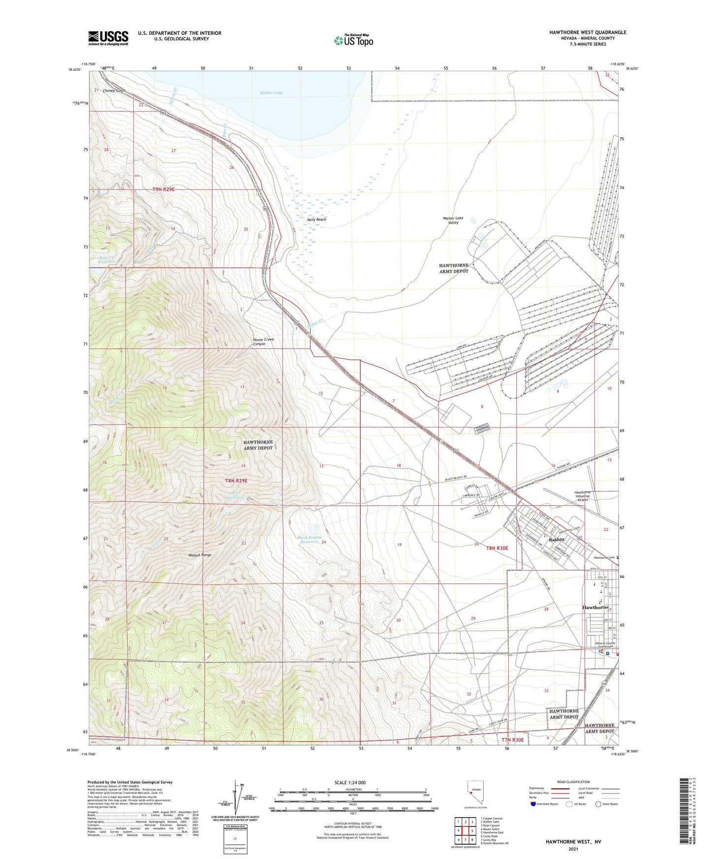
2023 topographic map quadrangle Hawthorne West in the state of Nevada. Scale: 1:24000. Based on the newly updated USGS 7.5' US Topo map series, this map is in the following counties: Mineral. The map contains contour data, water features, and other items you are used to seeing on USGS maps, but also has updated roads and other features. This is the next generation of topographic maps. Printed on high-quality waterproof paper with UV fade-resistant inks.
Quads adjacent to this one:
West: Mount Grant
Northwest: Copper Canyon
North: Walker Lake
Northeast: Ryan Canyon
East: Hawthorne East
Southeast: Powell Mountain NE
South: Lucky Boy
Southwest: Corey Peak
This map covers the same area as the classic USGS quad with code o38118e6.
Contains the following named places: Babbitt, Babbitt Branch Post Office, Black Beauty Dam, Black Beauty Reservoir, Cat Creek, Cat Creek Dam, Cat Creek Reservoir, Chaney Gulch, Day and Zimmerman Hawthorne Corporation Fire and Emergency Services, Hawthorne Cemetery, Hawthorne Census Designated Place, Hawthorne Division, Hawthorne Elementary School, Hawthorne Industrial Airport, Hawthorne Primary School, Hawthorne Township, House Creek, House Creek Canyon, Lady Bird Park, Lefa Seran Skilled Nursing Facility, Mineral County Fire Department, Mineral County High School, Mineral County Sheriff's Office, Mount Grant General Hospital, Naval Ammunition Depot Branch Post Office, Navy Beach, Nevada Highway Patrol Northern Command Hawthorne, Rose Creek, Rose Creek Dam, Rose Creek Reservoir, Schweer Housing Area, Sky View Academy, Squaw Creek, Walker Lake Valley