MyTopo
Hinkson Slough Nevada US Topo Map
Couldn't load pickup availability
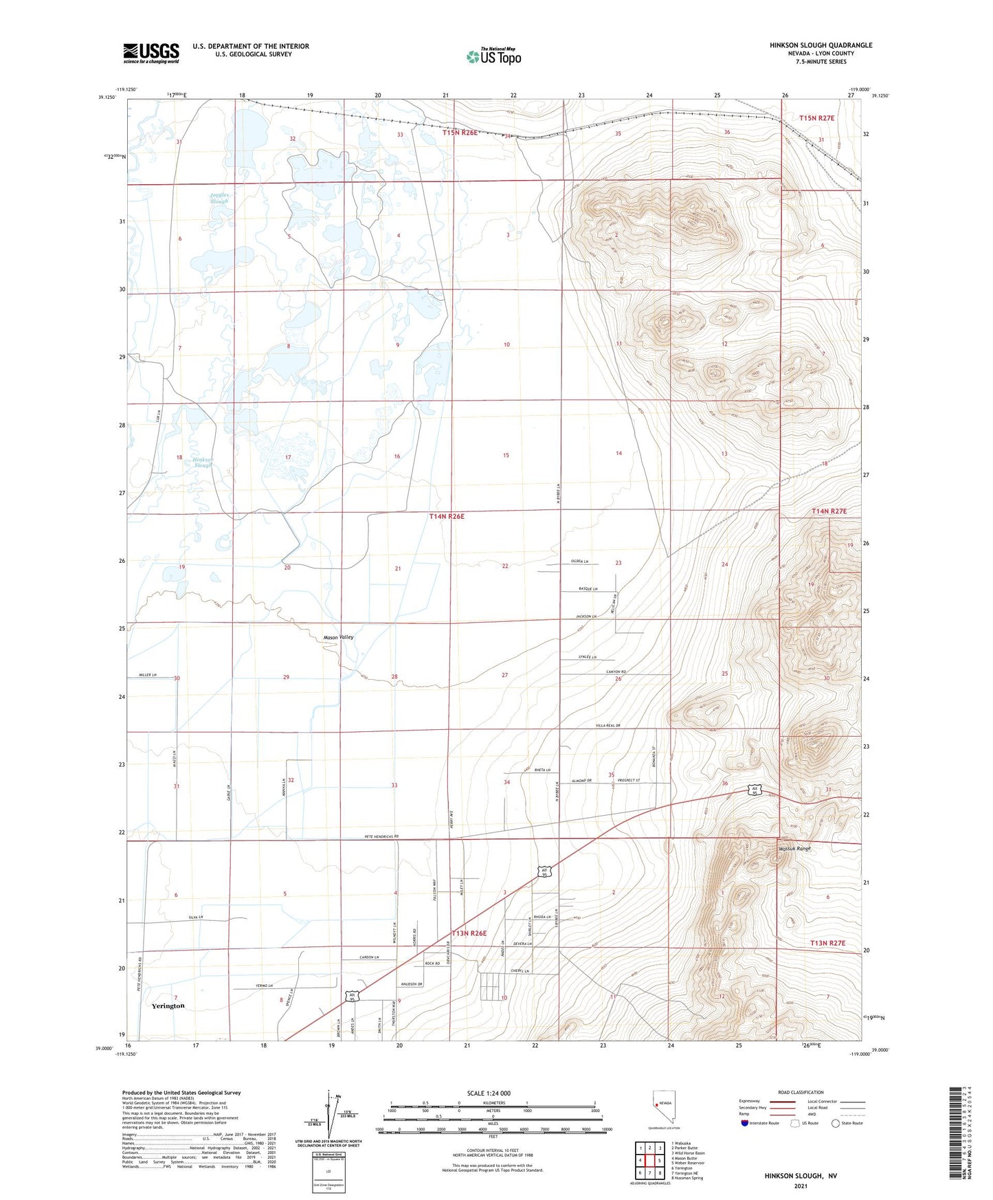
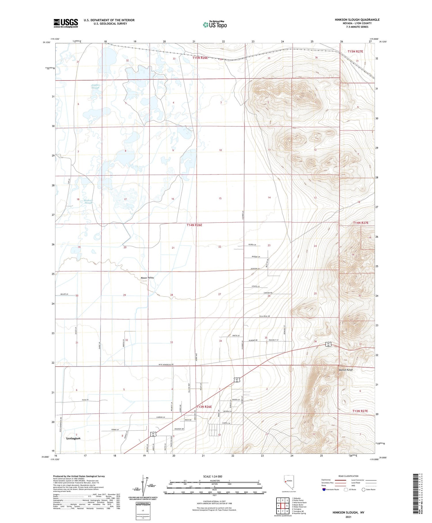
2021 topographic map quadrangle Hinkson Slough in the state of Nevada. Scale: 1:24000. Based on the newly updated USGS 7.5' US Topo map series, this map is in the following counties: Lyon. The map contains contour data, water features, and other items you are used to seeing on USGS maps, but also has updated roads and other features. This is the next generation of topographic maps. Printed on high-quality waterproof paper with UV fade-resistant inks.
Quads adjacent to this one:
West: Mason Butte
Northwest: Wabuska
North: Parker Butte
Northeast: Wild Horse Basin
East: Weber Reservoir
Southeast: Hussman Spring
South: Yerington NE
Southwest: Yerington
Contains the following named places: Bar G Ranch, Cleaver, Hinkson Slough, Joggles Ditch, Joggles Slough, Landolf Ranch, Lazy S Ranch, Mason Valley Ranch, Mason Valley Wildlife Management Area, Merritt Ditch, Neck Yoke Ranch, Ritter Ranch