MyTopo
Mason Butte Nevada US Topo Map
Couldn't load pickup availability
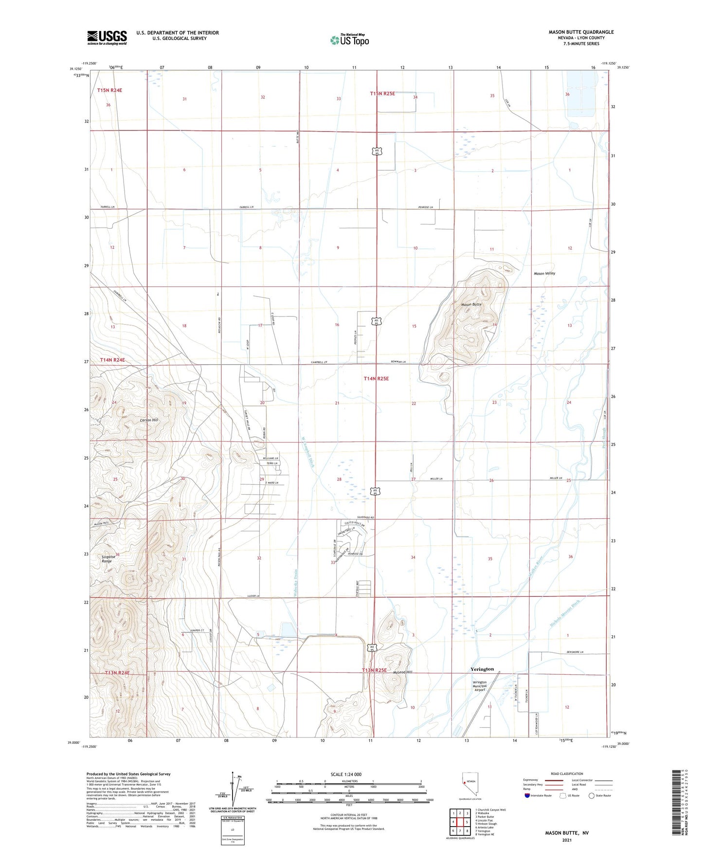
2021 topographic map quadrangle Mason Butte in the state of Nevada. Scale: 1:24000. Based on the newly updated USGS 7.5' US Topo map series, this map is in the following counties: Lyon. The map contains contour data, water features, and other items you are used to seeing on USGS maps, but also has updated roads and other features. This is the next generation of topographic maps. Printed on high-quality waterproof paper with UV fade-resistant inks.
Quads adjacent to this one:
West: Lincoln Flat
Northwest: Churchill Canyon Well
North: Wabuska
Northeast: Parker Butte
East: Hinkson Slough
Southeast: Yerington NE
South: Yerington
Southwest: Artesia Lake
This map covers the same area as the classic USGS quad with code o39119a2.
Contains the following named places: Campbell, Campbell Ditch, Campbell Ranch, Carson Hill, East Campbell Ditch, Farias Well, Fort Churchill Cooling Ponds, Greenville, L - M Feedlot, Lyon County, Mason Butte, Mason Valley, McGowan Corner, McKay, McLeod Hill, Nichols-Merritt Ditch, Poli Ranch, Rite of Passage High School, Sand Ridge Ditch, Spragg-Alcorn-Bewley Ditch, Wabuska Drain, West Campbell Ditch, West Hyland Ditch, Yerington Mill Dam, Yerington Mill Number Two Dam, Yerington Mill Pond AA Dam, Yerington Mill Pond BB Dam, Yerington Municipal Airport