MyTopo
Wabuska Nevada US Topo Map
Couldn't load pickup availability
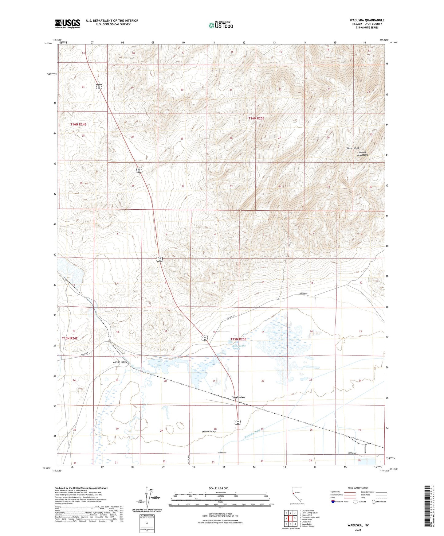
2021 topographic map quadrangle Wabuska in the state of Nevada. Scale: 1:24000. Based on the newly updated USGS 7.5' US Topo map series, this map is in the following counties: Lyon. The map contains contour data, water features, and other items you are used to seeing on USGS maps, but also has updated roads and other features. This is the next generation of topographic maps. Printed on high-quality waterproof paper with UV fade-resistant inks.
Quads adjacent to this one:
West: Churchill Canyon Well
Northwest: Churchill Butte
North: Silver Springs South
Northeast: Hooten Well
East: Parker Butte
Southeast: Hinkson Slough
South: Mason Butte
Southwest: Lincoln Flat
This map covers the same area as the classic USGS quad with code o39119b2.
Contains the following named places: Adrian Valley, Bolster Ranch, Cleaver Peak, Desert Mountains, Perazzo Slough, Thompson, Thompson Post Office, Thompson Smelter, Wabuska, Wabuska Hot Springs, Wabuska Post Office, Wabuska Quarry