MyTopo
Hot Springs Creek Nevada US Topo Map
Couldn't load pickup availability
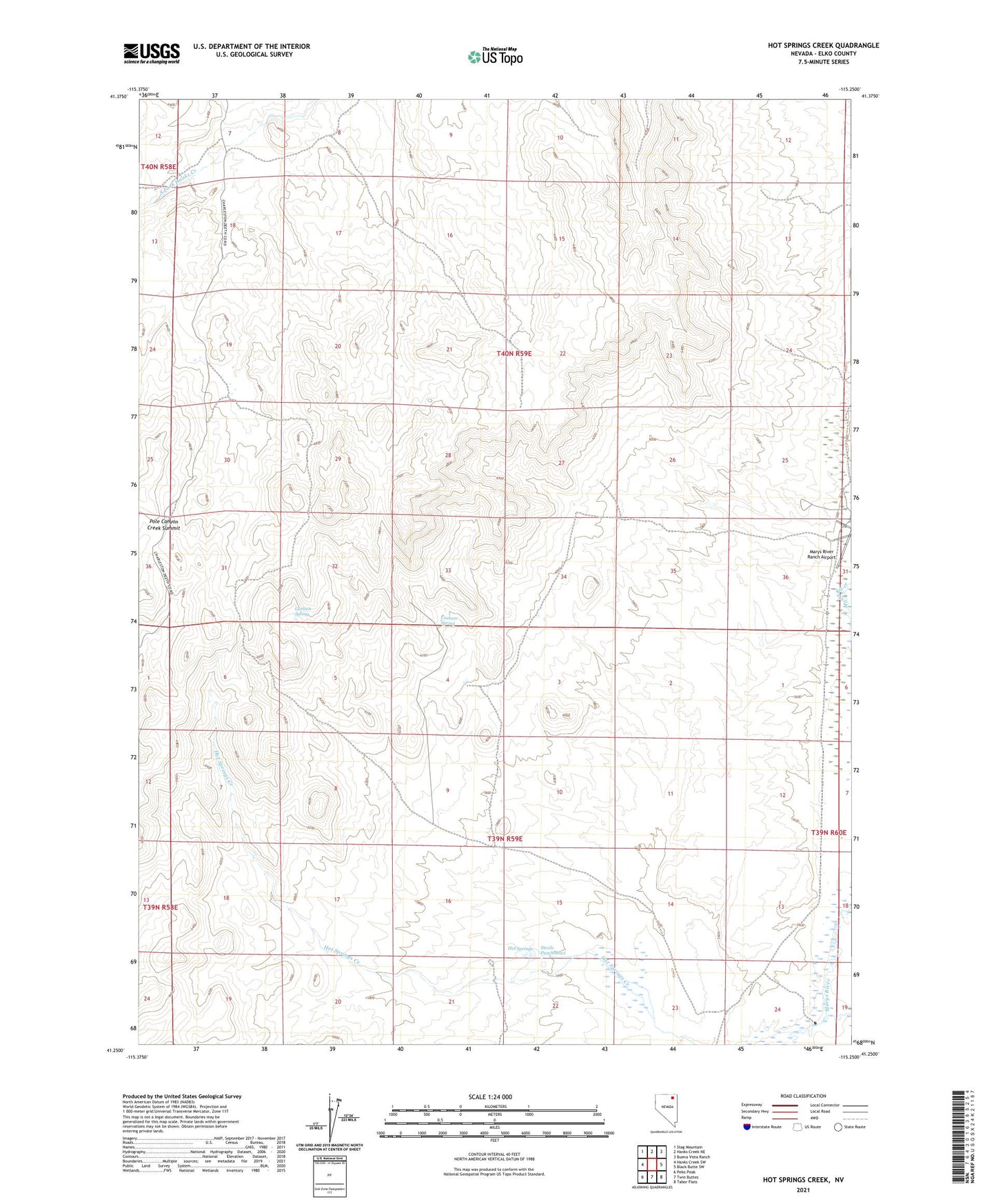
2021 topographic map quadrangle Hot Springs Creek in the state of Nevada. Scale: 1:24000. Based on the newly updated USGS 7.5' US Topo map series, this map is in the following counties: Elko. The map contains contour data, water features, and other items you are used to seeing on USGS maps, but also has updated roads and other features. This is the next generation of topographic maps. Printed on high-quality waterproof paper with UV fade-resistant inks.
Quads adjacent to this one:
West: Hanks Creek SW
Northwest: Stag Mountain
North: Hanks Creek NE
Northeast: Buena Vista Ranch
East: Black Butte SW
Southeast: Tabor Flats
South: Twin Buttes
Southwest: Peko Peak
This map covers the same area as the classic USGS quad with code o41115c3.
Contains the following named places: Carlson Spring, Devils Punch Bowl, Hot Springs, Mala Vista Ranch, Pole Canyon Creek Summit