MyTopo
Iron Point Nevada US Topo Map
Couldn't load pickup availability
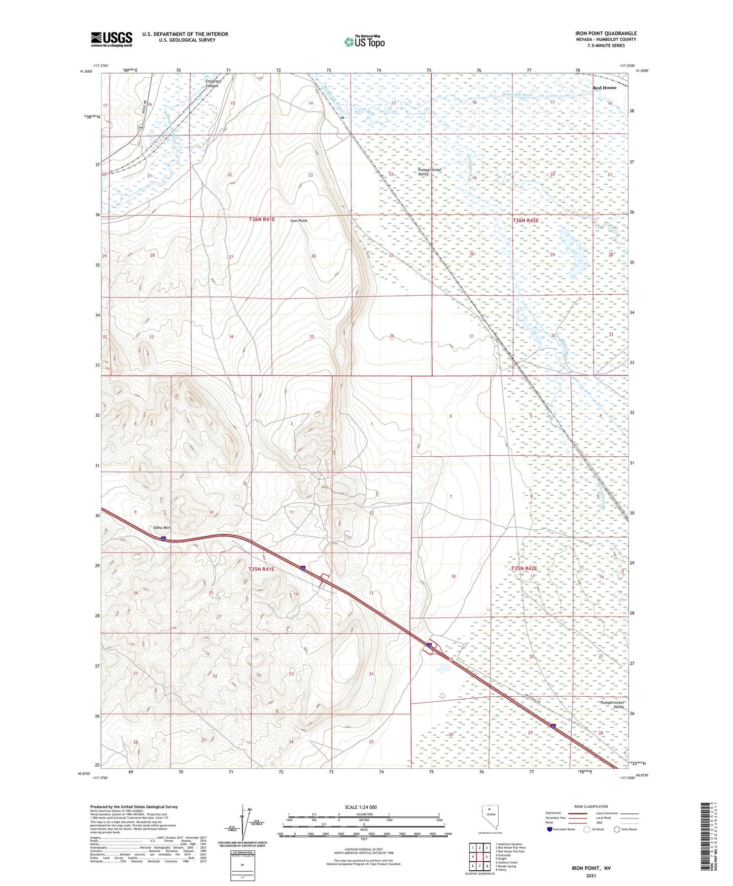
2021 topographic map quadrangle Iron Point in the state of Nevada. Scale: 1:24000. Based on the newly updated USGS 7.5' US Topo map series, this map is in the following counties: Humboldt. The map contains contour data, water features, and other items you are used to seeing on USGS maps, but also has updated roads and other features. This is the next generation of topographic maps. Printed on high-quality waterproof paper with UV fade-resistant inks.
Quads adjacent to this one:
West: Golconda
Northwest: Anderson Gardens
North: Red House Flat West
Northeast: Red House Flat East
East: Knight
Southeast: Valmy
South: Brooks Spring
Southwest: Goldrun Creek
This map covers the same area as the classic USGS quad with code o40117h3.
Contains the following named places: Herrin Slough, Iron Point, Iron Point Mining District, Iron Point Post Office, Iron Point Station, Pumpernickel Valley, Silver Coin Mine, Silver King Mine