MyTopo
Kennedy Canyon Nevada US Topo Map
Couldn't load pickup availability
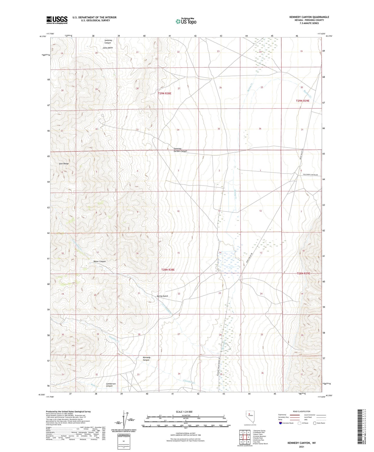
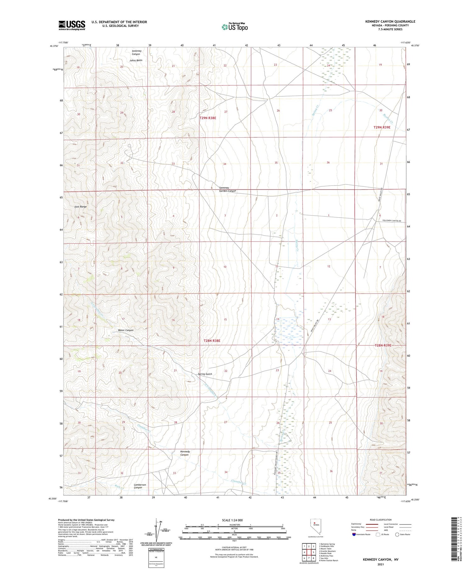
2021 topographic map quadrangle Kennedy Canyon in the state of Nevada. Scale: 1:24000. Based on the newly updated USGS 7.5' US Topo map series, this map is in the following counties: Pershing. The map contains contour data, water features, and other items you are used to seeing on USGS maps, but also has updated roads and other features. This is the next generation of topographic maps. Printed on high-quality waterproof paper with UV fade-resistant inks.
Quads adjacent to this one:
West: Granite Mountain
Northwest: Bartomes Spring
North: Goldbanks Hills
Northeast: Mount Tobin
East: Needle Peak
Southeast: Home Station Ranch
South: Sou Hills
Southwest: McKinney Pass
Contains the following named places: Bushee Creek, Guthrie Ranch, Hidden Treasure Mine, Imperial Mill, Imperial Mines, Jackpot Mine, Kennedy, Kennedy Canyon, Kennedy Mine, Kennedy Post Office, Kennedy School, Lamberson Canyon, North Cinnabar Creek, Pole Creek, Ringing Well, Sarret Ranch, Spring Gulch, Sunnyside Mines, Sweeney Garden Canyon, Water Canyon