MyTopo
Granite Mountain Nevada US Topo Map
Couldn't load pickup availability
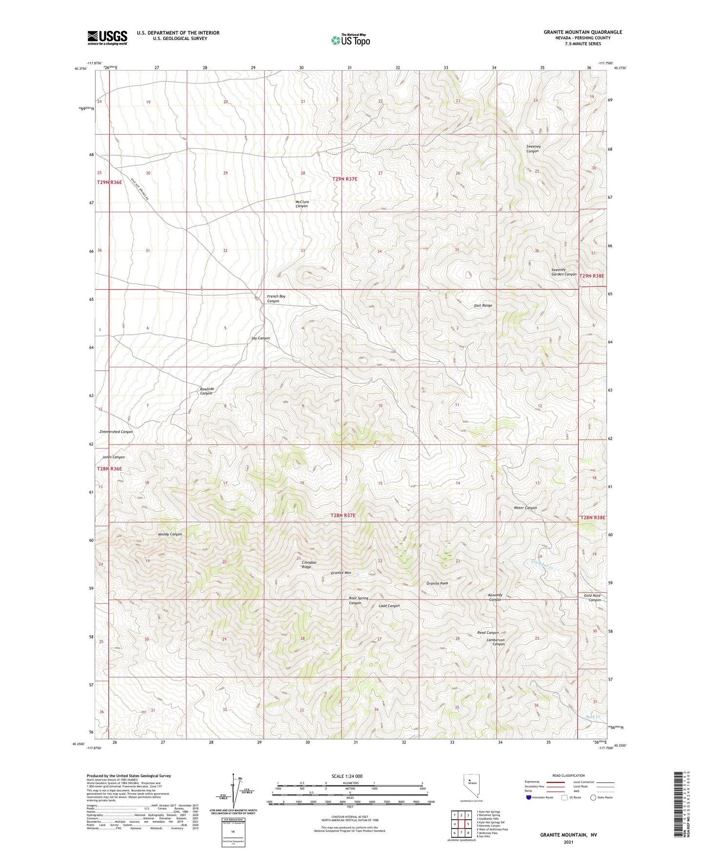
2021 topographic map quadrangle Granite Mountain in the state of Nevada. Scale: 1:24000. Based on the newly updated USGS 7.5' US Topo map series, this map is in the following counties: Pershing. The map contains contour data, water features, and other items you are used to seeing on USGS maps, but also has updated roads and other features. This is the next generation of topographic maps. Printed on high-quality waterproof paper with UV fade-resistant inks.
Quads adjacent to this one:
West: Kyle Hot Springs SW
Northwest: Kyle Hot Springs
North: Bartomes Spring
Northeast: Goldbanks Hills
East: Kennedy Canyon
Southeast: Sou Hills
South: McKinney Pass
Southwest: West of McKinney Pass
This map covers the same area as the classic USGS quad with code o40117c7.
Contains the following named places: Cinnabar Ridge, Folsom Ranch, French Boy Canyon, Gold Note Canyon, Gold Note Mine, Granite Mountain, Granite Peak, Henrietta Mine, Jones Canyon, Kennedy Mining District, McClure Canyon, Rawhide Canyon, Rileyville, Say Canyon, Zimmershed Canyon