MyTopo
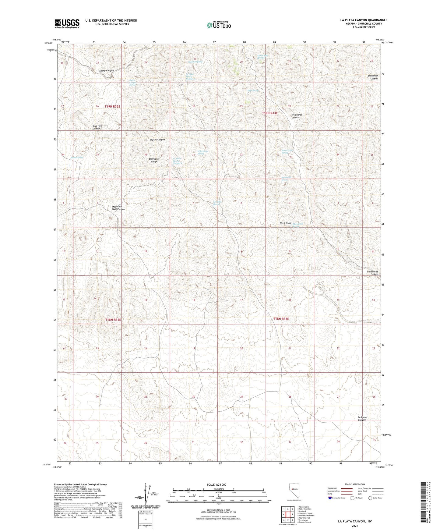
La Plata Canyon Nevada US Topo Map
Couldn't load pickup availability
2021 topographic map quadrangle La Plata Canyon in the state of Nevada. Scale: 1:24000. Based on the newly updated USGS 7.5' US Topo map series, this map is in the following counties: Churchill. The map contains contour data, water features, and other items you are used to seeing on USGS maps, but also has updated roads and other features. This is the next generation of topographic maps. Printed on high-quality waterproof paper with UV fade-resistant inks.
Quads adjacent to this one:
West: Diamond Canyon
Northwest: Foxtail Lake
North: Table Mountain
Northeast: Job Peak
East: Pirouette Mountain
Southeast: Drumm Summit
South: Frenchman
Southwest: Fourmile Flat
Contains the following named places: Black Knob, Black Knob Spring, Buckbrush Spring, Burnt Cabin Spring, Eleven Mile Springs, Hike Spring, La Plata, La Plata Canyon, La Plata City Post Office, La Plata Mining District, La Plata Spring, La Plata Spring Number 2, La Plata Spring Number 3, Mountain Well, Mountain Well Station, Ripley Spring, Sheep Canyon Spring, Sheep Canyon Well, Summit Spring, Upper Sheep Canyon Well, Wild Horse Spring, Wildhorse Canyon