MyTopo
Foxtail Lake Nevada US Topo Map
Couldn't load pickup availability
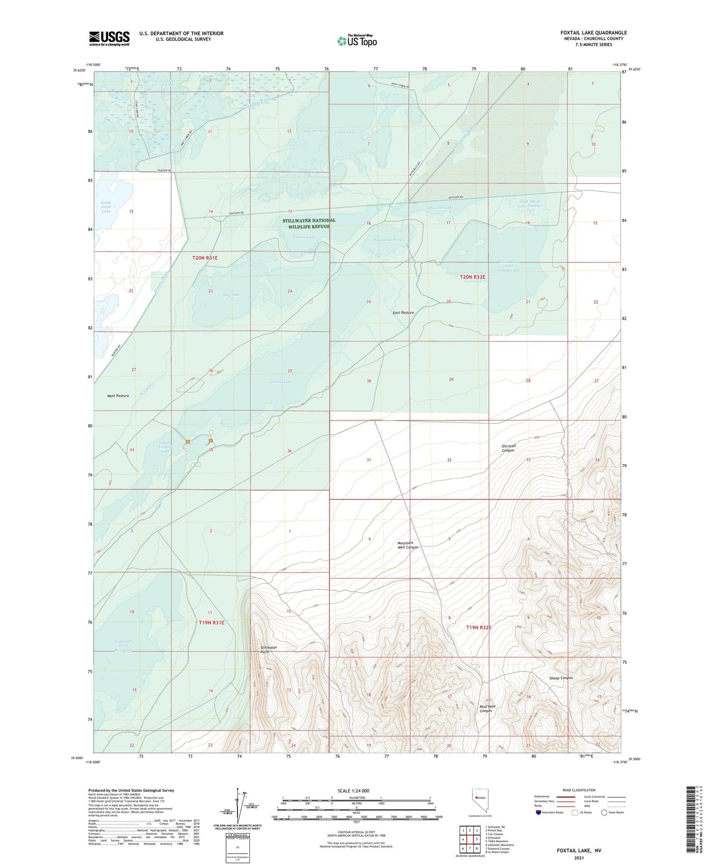
2021 topographic map quadrangle Foxtail Lake in the state of Nevada. Scale: 1:24000. Based on the newly updated USGS 7.5' US Topo map series, this map is in the following counties: Churchill. The map contains contour data, water features, and other items you are used to seeing on USGS maps, but also has updated roads and other features. This is the next generation of topographic maps. Printed on high-quality waterproof paper with UV fade-resistant inks.
Quads adjacent to this one:
West: Stillwater
Northwest: Stillwater NE
North: Pintail Bay
Northeast: Cox Canyon
East: Table Mountain
Southeast: La Plata Canyon
South: Diamond Canyon
Southwest: Lahontan Mountains
This map covers the same area as the classic USGS quad with code o39118e4.
Contains the following named places: Cattail Lake, Division Lake, Dog Head Pond, Dry Lake, East Alkali Lake Number One, East Alkali Lake Number Two, East Canal, East Pasture, East Pasture Corral, Fourmile Point Well, Foxtail Lake, Goose Lake, Goose Lake Bypass, Goose Landing, Hunter Drain, Lead Lake Canal, Lower Sheep Canyon Well, Mountain Well Canyon, Mud Hole Canyon, Pappis Pond, Point of the Mountain Well, Rice Landing, Sheep Canyon, Shirttail Canyon, Shirttail Well, South Lead Lake, Stillwater Marsh, Stillwater National Wildlife Refuge, Stillwater Point, Stillwater Point Dam, Tule Lake, Upper Foxtail Lake, West Canal, West Pasture, West Ripley Canyon Well