MyTopo
Table Mountain Nevada US Topo Map
Couldn't load pickup availability
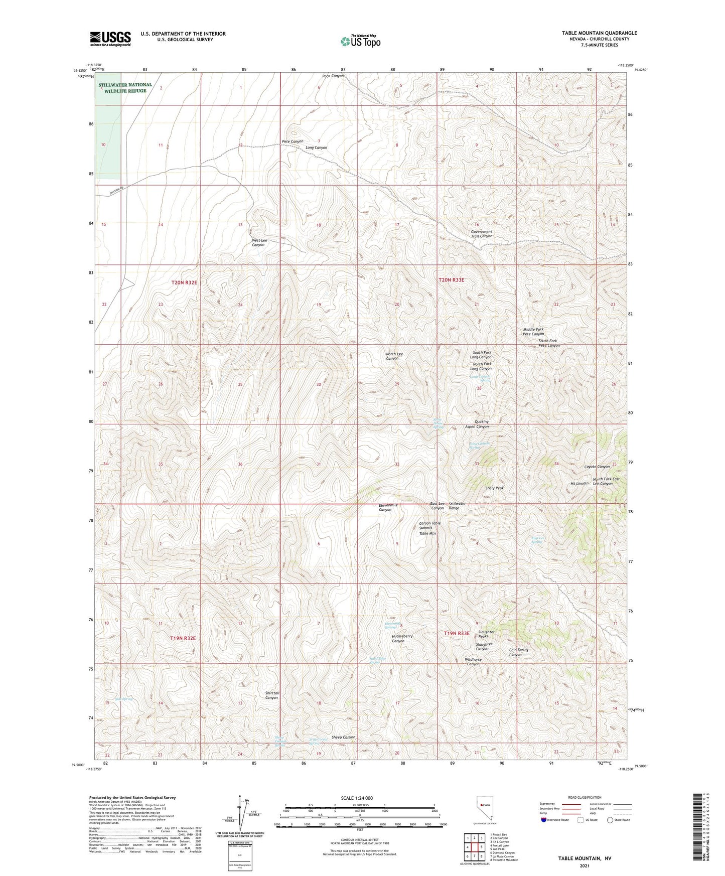
2021 topographic map quadrangle Table Mountain in the state of Nevada. Scale: 1:24000. Based on the newly updated USGS 7.5' US Topo map series, this map is in the following counties: Churchill. The map contains contour data, water features, and other items you are used to seeing on USGS maps, but also has updated roads and other features. This is the next generation of topographic maps. Printed on high-quality waterproof paper with UV fade-resistant inks.
Quads adjacent to this one:
West: Foxtail Lake
Northwest: Pintail Bay
North: Cox Canyon
Northeast: I X L Canyon
East: Job Peak
Southeast: Pirouette Mountain
South: La Plata Canyon
Southwest: Diamond Canyon
This map covers the same area as the classic USGS quad with code o39118e3.
Contains the following named places: Carson Table Summit, Churchill County, East Lee Spring, Elevenmile Springs, Government Trail Canyon, Hard Time Spring, Huckleberry Canyon, Long Canyon, Long Canyon Spring, Long Canyon Well, Middle Fork Pete Canyon, Mount Lincoln, North Fork Long Canyon, North Lee Canyon, Pete Canyon, Quaking Aspen Canyon, Shaly Peak, Sheep Canyon Spring, Side Spring, Slaughter Peaks, South Fork Long Canyon, South Fork Pete Canyon, Stone House Spring, Table Mountain, Trap Corral Spring, West Lee Canyon, West Lee Well, ZIP Code: 89406