MyTopo
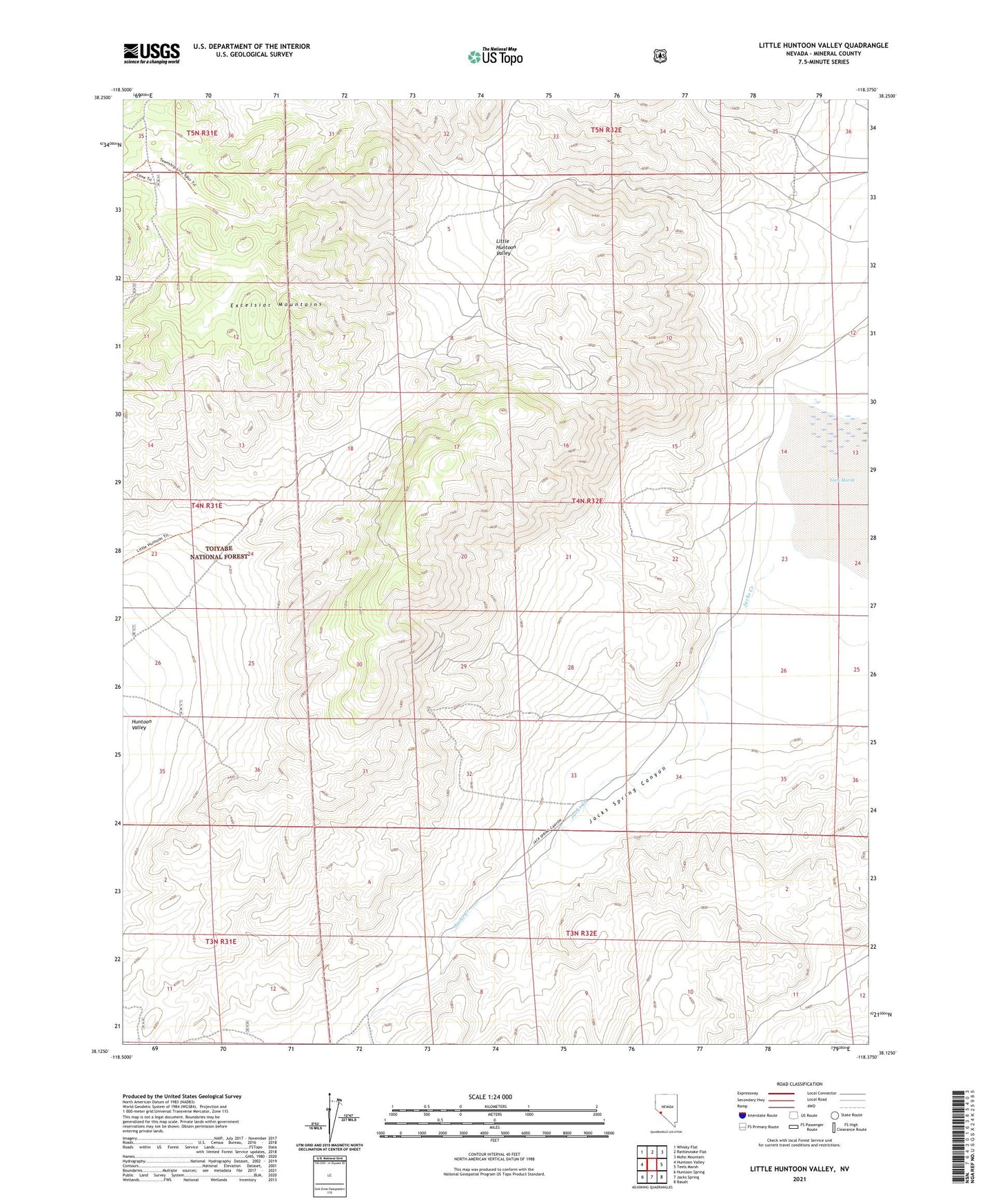
Little Huntoon Valley Nevada US Topo Map
Couldn't load pickup availability
Also explore the Little Huntoon Valley Forest Service Topo of this same quad for updated USFS data
2021 topographic map quadrangle Little Huntoon Valley in the state of Nevada. Scale: 1:24000. Based on the newly updated USGS 7.5' US Topo map series, this map is in the following counties: Mineral. The map contains contour data, water features, and other items you are used to seeing on USGS maps, but also has updated roads and other features. This is the next generation of topographic maps. Printed on high-quality waterproof paper with UV fade-resistant inks.
Quads adjacent to this one:
West: Huntoon Valley
Northwest: Whisky Flat
North: Rattlesnake Flat
Northeast: Moho Mountain
East: Teels Marsh
Southeast: Basalt
South: Jacks Spring
Southwest: Huntoon Spring
This map covers the same area as the classic USGS quad with code o38118b4.
Contains the following named places: Defender Mine, Fletcher Camp, Jacks Creek, Jacks Spring Canyon, Little Huntoon Valley, Pine Crow Mine, Silver Moon Mine, ZIP Code: 89422