MyTopo
Lovelock Nevada US Topo Map
Couldn't load pickup availability
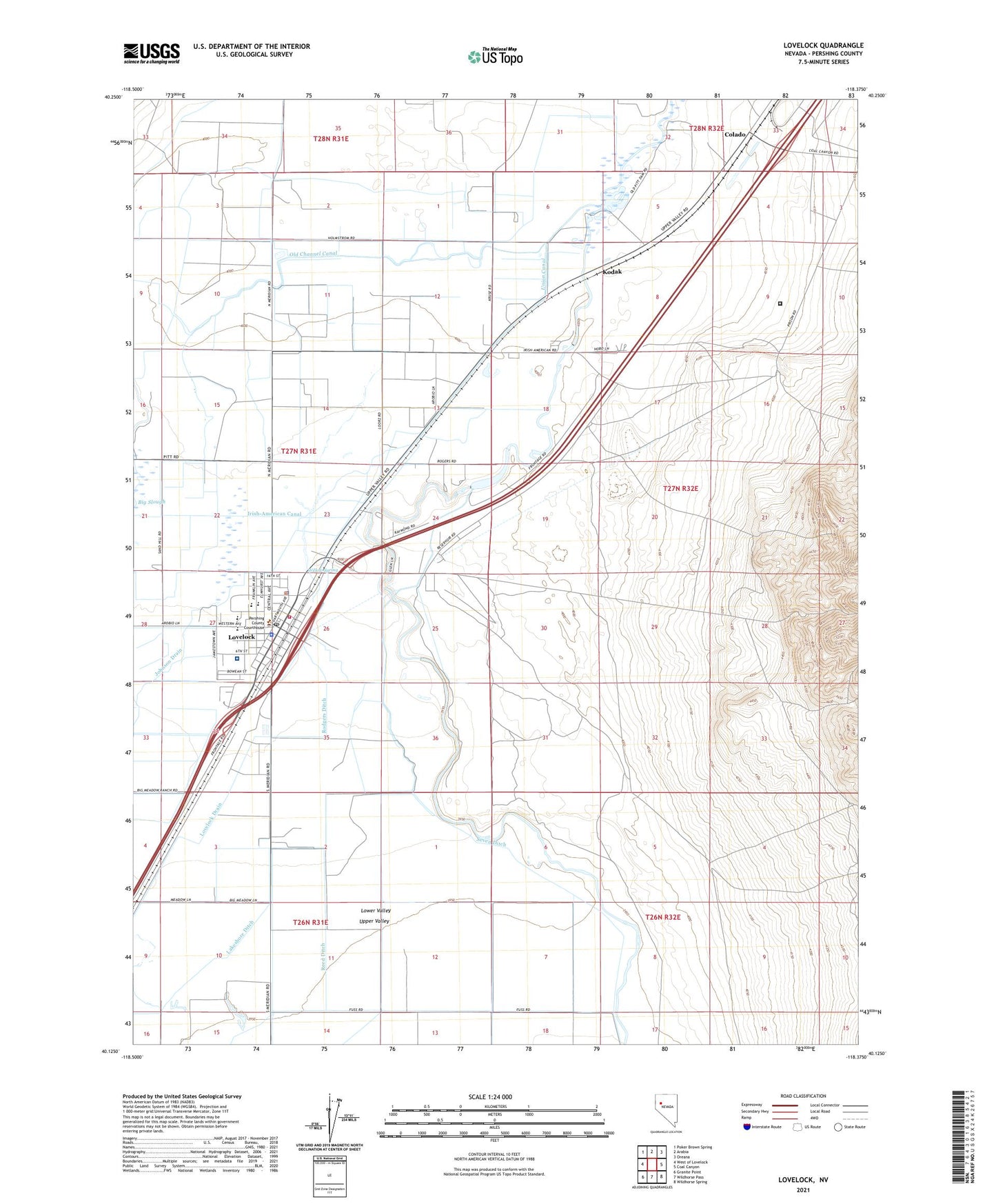
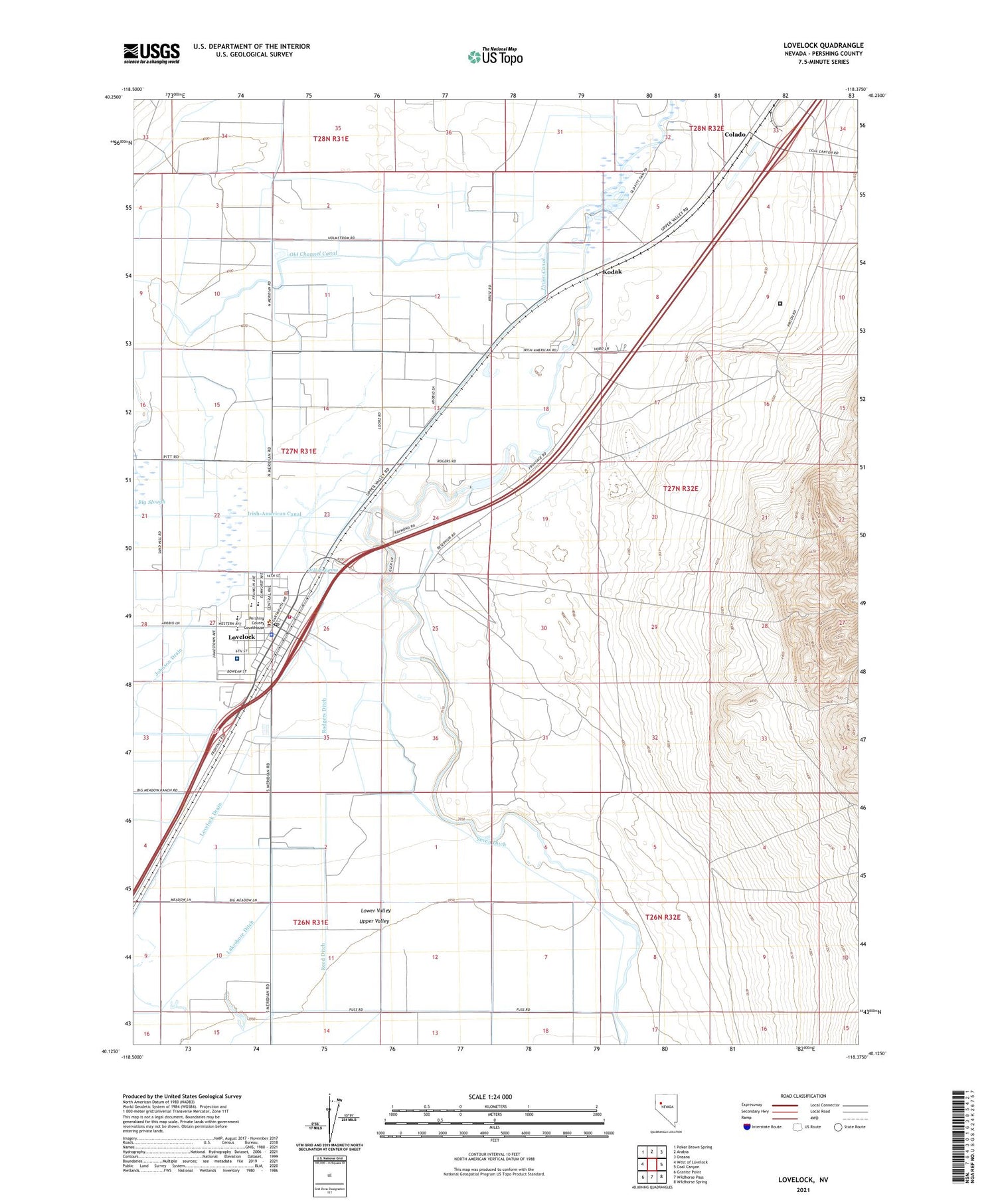
2021 topographic map quadrangle Lovelock in the state of Nevada. Scale: 1:24000. Based on the newly updated USGS 7.5' US Topo map series, this map is in the following counties: Pershing. The map contains contour data, water features, and other items you are used to seeing on USGS maps, but also has updated roads and other features. This is the next generation of topographic maps. Printed on high-quality waterproof paper with UV fade-resistant inks.
Quads adjacent to this one:
West: West of Lovelock
Northwest: Poker Brown Spring
North: Arabia
Northeast: Oreana
East: Coal Canyon
Southeast: Wildhorse Spring
South: Wildhorse Pass
Southwest: Granite Point
Contains the following named places: American Canal, Big Meadow Ranch, Circle L Ranch, City of Lovelock, Colado, Colado Mill Dam, Fairview Slough, Graveyard Drain, Irish-American Canal, Irish-American Dam, Johnson Drain, Kodak, Lovelock, Lovelock Correctional Center, Lovelock Drain, Lovelock Elementary School, Lovelock Indian Colony, Lovelock Landing Strip, Lovelock Police Department, Lovelock Post Office, Lovelock Volunteer Fire Department, Lucky Lager Ranch, Mineral Materials Well, Munk Ranch, Nevada Highway Patrol Northern Command, Nevada Nile Copp Ranch, Old Channel Canal, Pallens Wells, Pershing County Court House, Pershing County High School, Pershing County Middle School, Pershing County Sheriff's Office, Pershing General Hospital, Pitt Dam, Reed Ditch, Rodgers Dam, Rodgers Ditch, Rudell Ditch, Taylor Canal, Union Canal, Union Rodgers Canal, Upper Valley, Upper Valley School, Willow Spring, Young Canal