MyTopo
Lower Pahranagat Lake Nevada US Topo Map
Couldn't load pickup availability
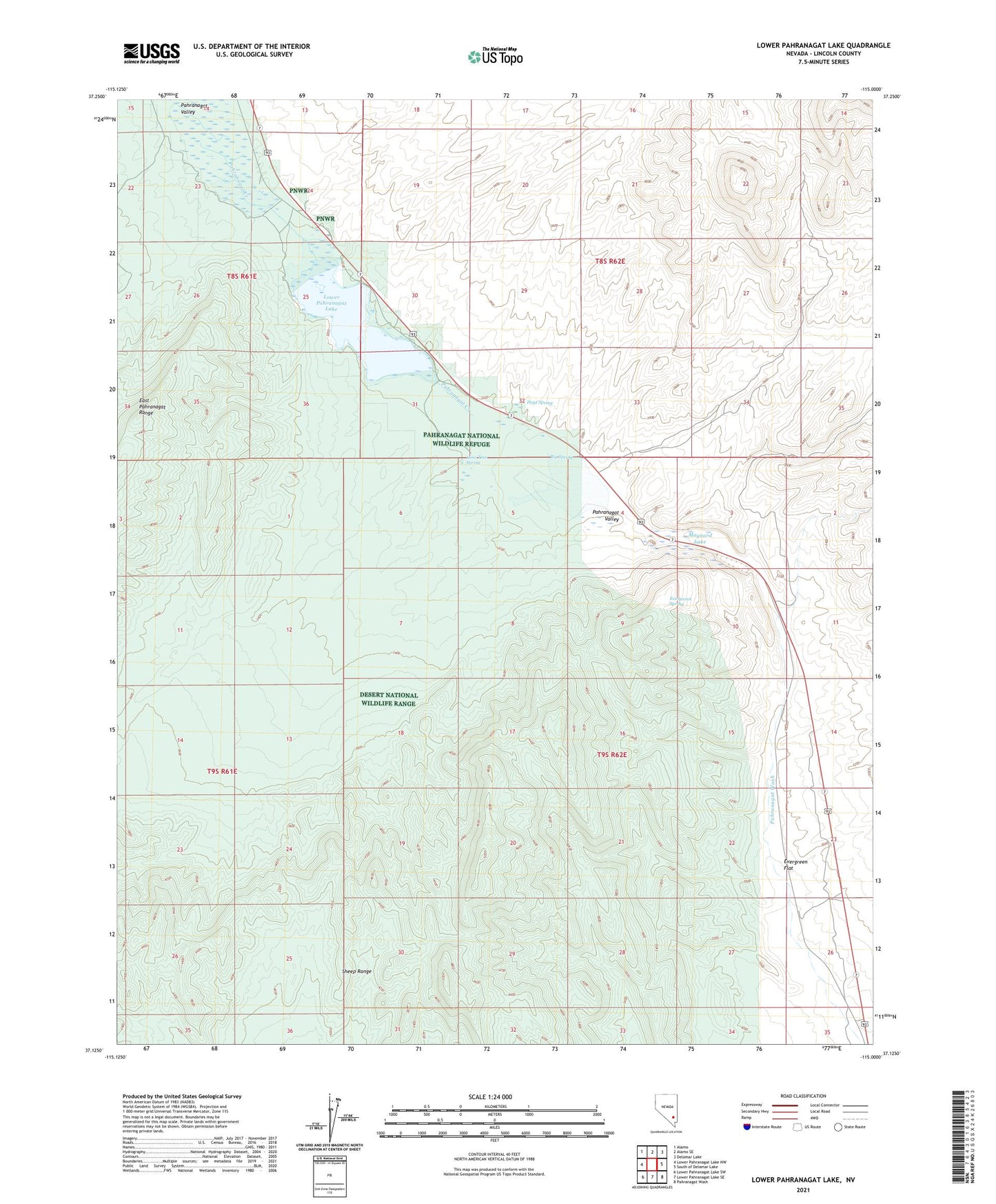
2021 topographic map quadrangle Lower Pahranagat Lake in the state of Nevada. Scale: 1:24000. Based on the newly updated USGS 7.5' US Topo map series, this map is in the following counties: Lincoln. The map contains contour data, water features, and other items you are used to seeing on USGS maps, but also has updated roads and other features. This is the next generation of topographic maps. Printed on high-quality waterproof paper with UV fade-resistant inks.
Quads adjacent to this one:
West: Lower Pahranagat Lake NW
Northwest: Alamo
North: Alamo SE
Northeast: Delamar Lake
East: South of Delamar Lake
Southeast: Pahranagat Wash
South: Lower Pahranagat Lake SE
Southwest: Lower Pahranagat Lake SW
This map covers the same area as the classic USGS quad with code o37115b1.
Contains the following named places: Big Spring, Evergreen Flat, Evergreen Spring, Gould Ranch, Hoyt Spring, Lone Tree Spring, Lower Pahranagat Lake, Maynard Lake, Middle Pond, Pahranagat Valley