MyTopo
Lusetti Canyon Nevada US Topo Map
Couldn't load pickup availability
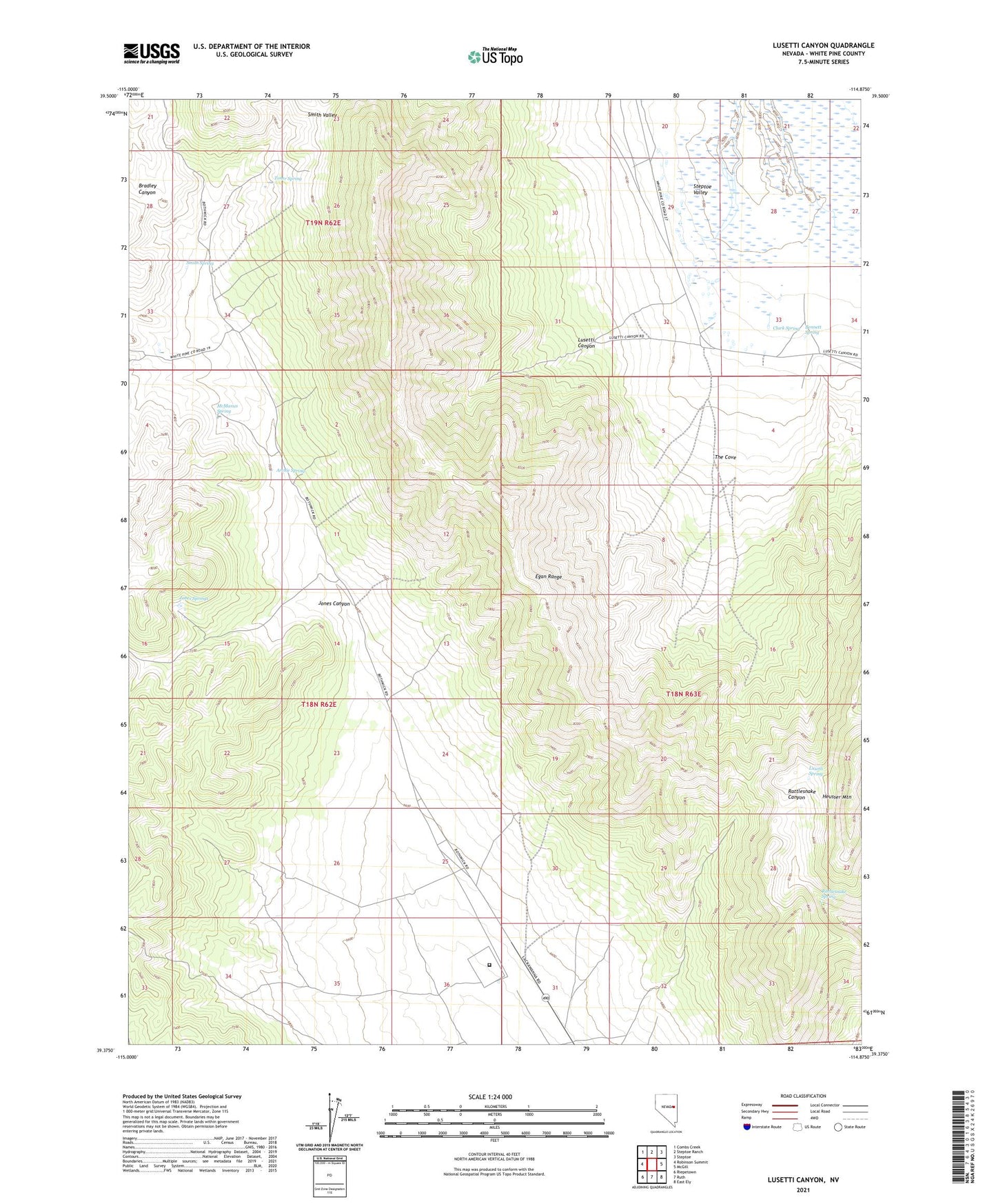
2021 topographic map quadrangle Lusetti Canyon in the state of Nevada. Scale: 1:24000. Based on the newly updated USGS 7.5' US Topo map series, this map is in the following counties: White Pine. The map contains contour data, water features, and other items you are used to seeing on USGS maps, but also has updated roads and other features. This is the next generation of topographic maps. Printed on high-quality waterproof paper with UV fade-resistant inks.
Quads adjacent to this one:
West: Robinson Summit
Northwest: Combs Creek
North: Steptoe Ranch
Northeast: Steptoe
East: McGill
Southeast: East Ely
South: Ruth
Southwest: Riepetown
Contains the following named places: Archie Spring, Bennett Spring, Bristlecone Wilderness, Clark Spring, Ely State Prison, Fera Forty, Fera Thirtyseven, Hercules Gap Well, Heusser Mountain, Jones Canyon, Jones Springs, Kogan Place, Lusetti Canyon, Lusetti Ranch, Lusetti Spring, McManus Spring, Mountain High School, Rattlesnake Spring, Smith Spring, The Cove, Toner Spring, White Pine County