MyTopo
McGill Nevada US Topo Map
Couldn't load pickup availability
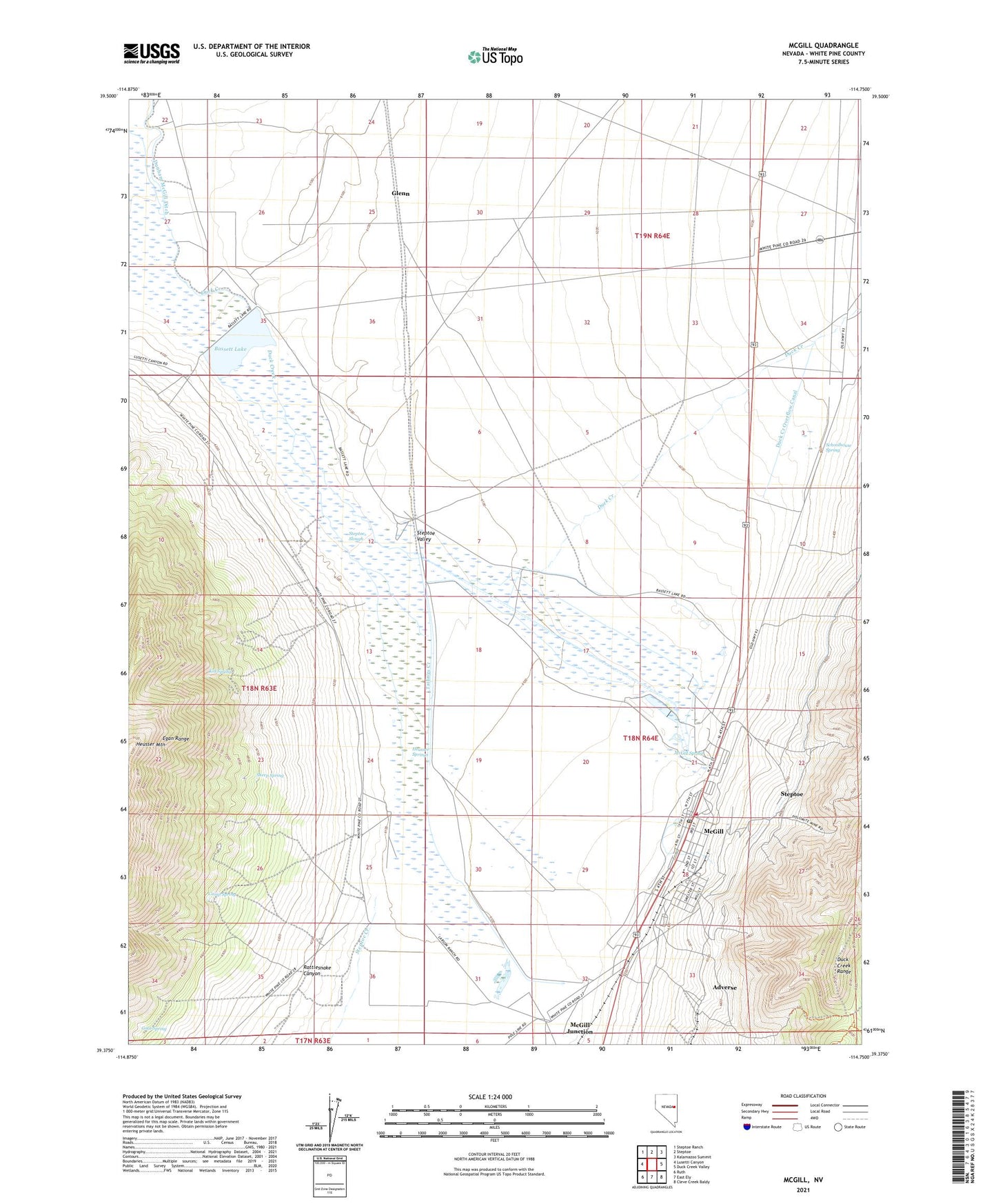
2021 topographic map quadrangle McGill in the state of Nevada. Scale: 1:24000. Based on the newly updated USGS 7.5' US Topo map series, this map is in the following counties: White Pine. The map contains contour data, water features, and other items you are used to seeing on USGS maps, but also has updated roads and other features. This is the next generation of topographic maps. Printed on high-quality waterproof paper with UV fade-resistant inks.
Quads adjacent to this one:
West: Lusetti Canyon
Northwest: Steptoe Ranch
North: Steptoe
Northeast: Kalamazoo Summit
East: Duck Creek Valley
Southeast: Cleve Creek Baldy
South: East Ely
Southwest: Ruth
This map covers the same area as the classic USGS quad with code o39114d7.
Contains the following named places: 171 Ac Pond-McGill Dam, 78 Ac Pond-McGill Dam, 89318, Adverse, Axehandle Pass, Basset Lake Dam, Bassett Lake, Camp Spring, Duck Creek Overflow Canal, Dunham McGill Ditch, Glenn, Goat Spring, Heusser Springs, Kid Spring, Mayflower Mine, McGill, McGill Census Designated Place, McGill Concentrator Dam, McGill Elementary School, McGill Post Office, McGill Spring, McGill Volunteer Fire Department, Nichols and Mackleys Ranch, Rattlesnake Canyon, Romeo Ranch, San Francisco Mining District, Schoolhouse Spring, Sheep Spring, Sorehead Tunnel, Steptoe, Steptoe Creek, Steptoe Slough, Tailings Creek, The Calcite, The Dolomite