MyTopo
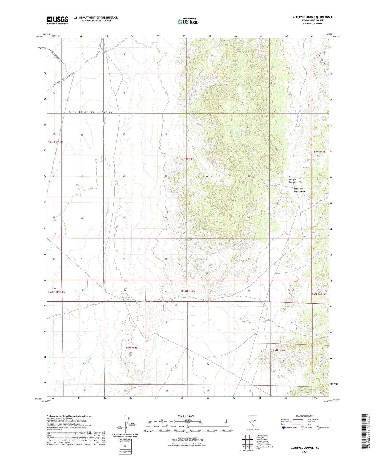
McIntyre Summit Nevada US Topo Map
Couldn't load pickup availability
Also explore the McIntyre Summit Forest Service Topo of this same quad for updated USFS data
2021 topographic map quadrangle McIntyre Summit in the state of Nevada. Scale: 1:24000. Based on the newly updated USGS 7.5' US Topo map series, this map is in the following counties: Nye. The map contains contour data, water features, and other items you are used to seeing on USGS maps, but also has updated roads and other features. This is the next generation of topographic maps. Printed on high-quality waterproof paper with UV fade-resistant inks.
Quads adjacent to this one:
West: McCann Canyon
Northwest: Elkhorn Canyon
North: Eagle Pass
Northeast: Little Fish Lake
East: Flagstaff Mountain
Southeast: Tybo
South: Georges Canyon Rim SE
Southwest: Georges Canyon Rim
This map covers the same area as the classic USGS quad with code o38116d5.
Contains the following named places: McIntyre Summit, White Rocks Canyon