MyTopo
Tybo Nevada US Topo Map
Couldn't load pickup availability
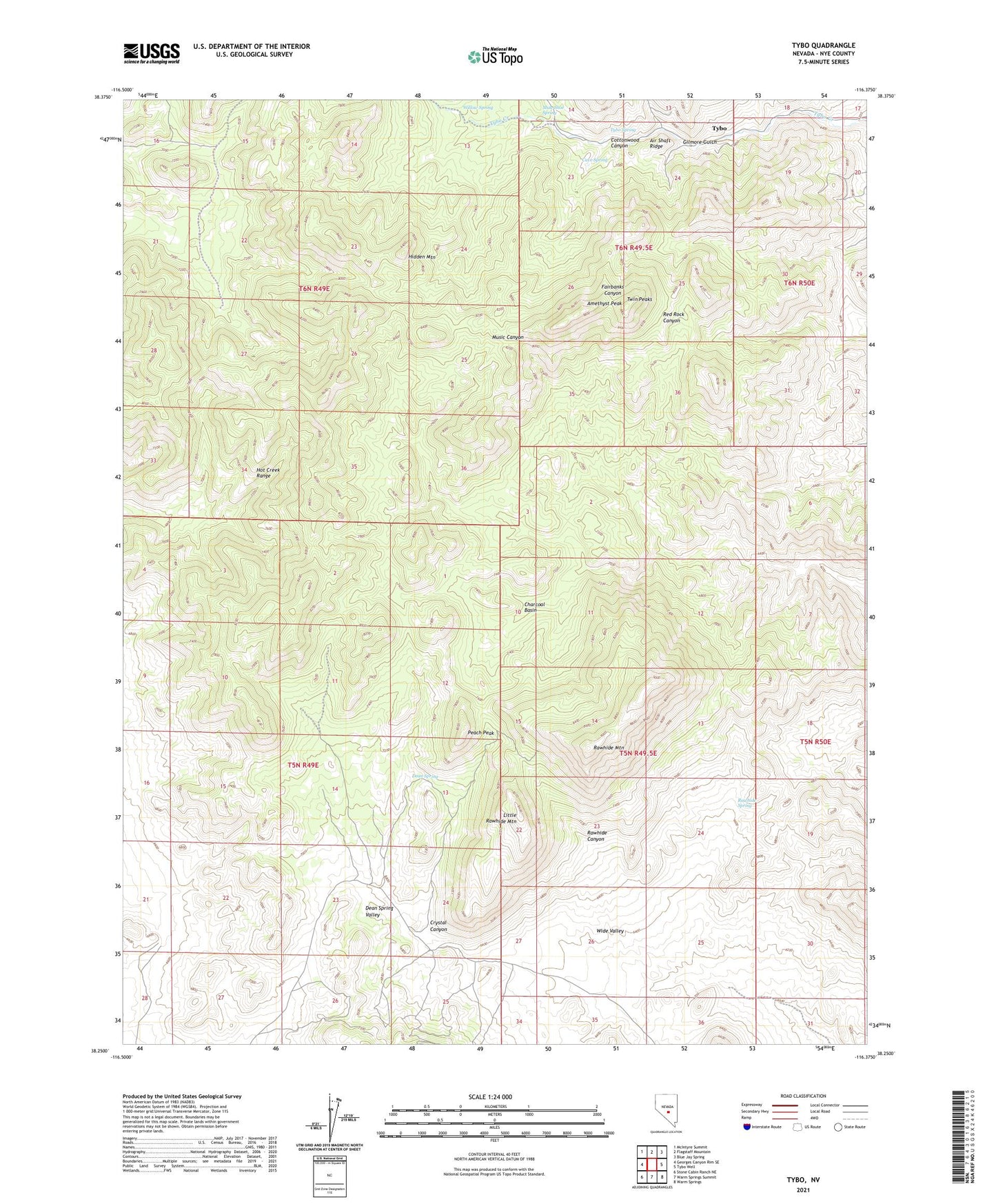
2021 topographic map quadrangle Tybo in the state of Nevada. Scale: 1:24000. Based on the newly updated USGS 7.5' US Topo map series, this map is in the following counties: Nye. The map contains contour data, water features, and other items you are used to seeing on USGS maps, but also has updated roads and other features. This is the next generation of topographic maps. Printed on high-quality waterproof paper with UV fade-resistant inks.
Quads adjacent to this one:
West: Georges Canyon Rim SE
Northwest: McIntyre Summit
North: Flagstaff Mountain
Northeast: Blue Jay Spring
East: Tybo Well
Southeast: Warm Springs
South: Warm Springs Summit
Southwest: Stone Cabin Ranch NE
This map covers the same area as the classic USGS quad with code o38116c4.
Contains the following named places: A and B Mine, Air Shaft Ridge, Amethyst Peak, Break Mine, Bunker Hill Mine, Butterfield Ranch, Casket Mine, Cave Spring, Charcoal Basin, Cottonwood Canyon, Crystal Canyon, Cunningham Mine, Dean Spring, Dean Spring Valley, Dimick Mine, Gilmore Gulch, Gilmore Mine, Hidden Mountain, Little Rawhide Mountain, M and M Mine, Mule Shoe Spring, Peach Peak, Rawhide Canyon, Rawhide Mountain, Rawhide Spring, Treadwell Yukon Mine, Twin Peaks, Two-G Mine, Tybo, Tybo Charcoal Kilns, Tybo Post Office, Tybo Spring, Western Extension Mine, Wide Valley, Willow Spring