MyTopo
Millett Ranch Nevada US Topo Map
Couldn't load pickup availability
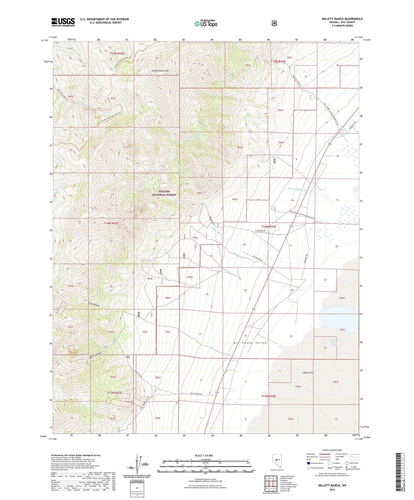
2021 topographic map quadrangle Millett Ranch in the state of Nevada. Scale: 1:24000. Based on the newly updated USGS 7.5' US Topo map series, this map is in the following counties: Nye. The map contains contour data, water features, and other items you are used to seeing on USGS maps, but also has updated roads and other features. This is the next generation of topographic maps. Printed on high-quality waterproof paper with UV fade-resistant inks.
Quads adjacent to this one:
West: Tierney Creek
Northwest: Reese River Butte
North: Brewer Canyon
Northeast: Kingston
East: East of Millett Ranch
Southeast: Carvers NE
South: Carvers NW
Southwest: South Toiyabe Peak
Contains the following named places: Alice Gendron Creek, Blue Spring, Cooper Incorporated Ranch, Decker Bob Creek, Decker Creek, Fremont Route, Gendron Ranch, Giant Mine, Gold Pocket Mine, Grandview Mine, Indian Ranch, Junction, Junction Post Office, McIntyre Mine, McLeod Creek, McLeod Ranch, McLeods Ranch Spring, Millett, Millett Mine, Millett Post Office, Millett Ranch, Park Canyon, Park Canyon Post Office, Pueblo, Saint Elena Patent, San Juan, Star Number One Mine, Timblin Creek, Toiyabe Crest Trail, Toiyabe Range Peak, Trail Canyon, Tungsten King Mine, Valley View and Foothill Mine, Viken Mine