MyTopo
South Toiyabe Peak Nevada US Topo Map
Couldn't load pickup availability
Also explore the South Toiyabe Peak Forest Service Topo of this same quad for updated USFS data
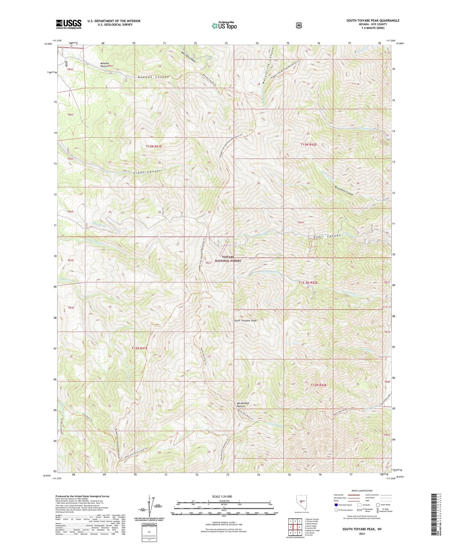
2021 topographic map quadrangle South Toiyabe Peak in the state of Nevada. Scale: 1:24000. Based on the newly updated USGS 7.5' US Topo map series, this map is in the following counties: Nye. The map contains contour data, water features, and other items you are used to seeing on USGS maps, but also has updated roads and other features. This is the next generation of topographic maps. Printed on high-quality waterproof paper with UV fade-resistant inks.
Quads adjacent to this one:
West: Corral Wash
Northwest: Barrett Canyon
North: Tierney Creek
Northeast: Millett Ranch
East: Carvers NW
Southeast: Carvers
South: Arc Dome
Southwest: Bakeoven Creek
This map covers the same area as the classic USGS quad with code o38117h3.
Contains the following named places: Buckeye Mine, Gruss Mine, Hamlin Mine, Mohawk Administrative Site, Mohawk Canyon, Mohawk Pasture, Murphy Mine, New Moose Tungsten Mine, Ophir, Ophir Mine, South Toiyabe Peak, Sullivar Mines, Summit Canyon Barite Mine, Twin River Mining District, Twin River Post Office, Werdenhoff Pasture, Werdenhoff Pasture Administrative Site