MyTopo
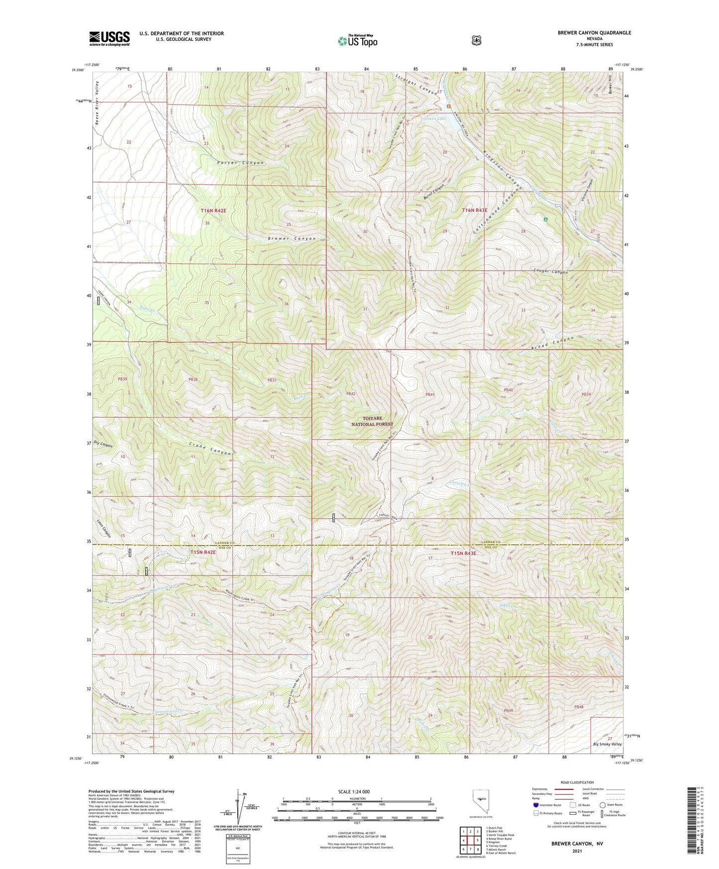
Brewer Canyon Nevada US Topo Map
Couldn't load pickup availability
Also explore the Brewer Canyon Forest Service Topo of this same quad for updated USFS data
2021 topographic map quadrangle Brewer Canyon in the state of Nevada. Scale: 1:24000. Based on the newly updated USGS 7.5' US Topo map series, this map is in the following counties: Lander, Nye. The map contains contour data, water features, and other items you are used to seeing on USGS maps, but also has updated roads and other features. This is the next generation of topographic maps. Printed on high-quality waterproof paper with UV fade-resistant inks.
Quads adjacent to this one:
West: Reese River Butte
Northwest: Dutch Flat
North: Bunker Hill
Northeast: North Toiyabe Peak
East: Kingston
Southeast: East of Millett Ranch
South: Millett Ranch
Southwest: Tierney Creek
This map covers the same area as the classic USGS quad with code o39117b2.
Contains the following named places: Adits Mill, Bi-Metallic Mine, Brewer Canyon, Brown Ledge Mine, Burnt Canyon, Cottonwood Canyon, Cougar Canyon, Crane Canyon, Daniel Ranch, Daniels, Gold Star Mine, Grand View Mine, Groves Lake, Horton Mine, Kingston Campground, Kingston Canyon Dam, Kingston Canyon Mine, Kingston Mining District, Porter Canyon, Straight Canyon, Victorine Canyon, Victorine Mine, Warner Mine, Washington, Washington Creek Trailhead, Washington Mining District, Washington Post Office