MyTopo
Mina Nevada US Topo Map
Couldn't load pickup availability
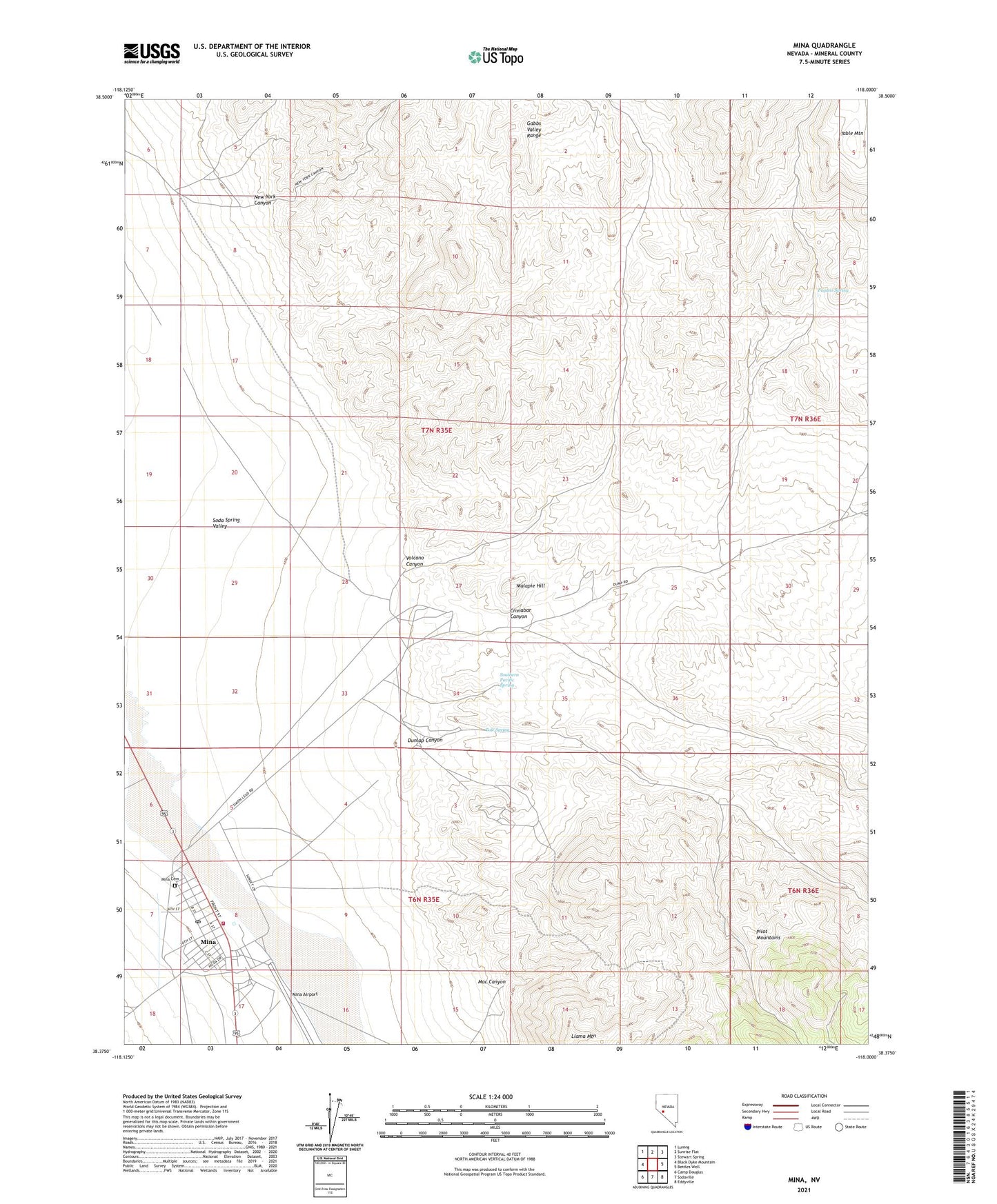
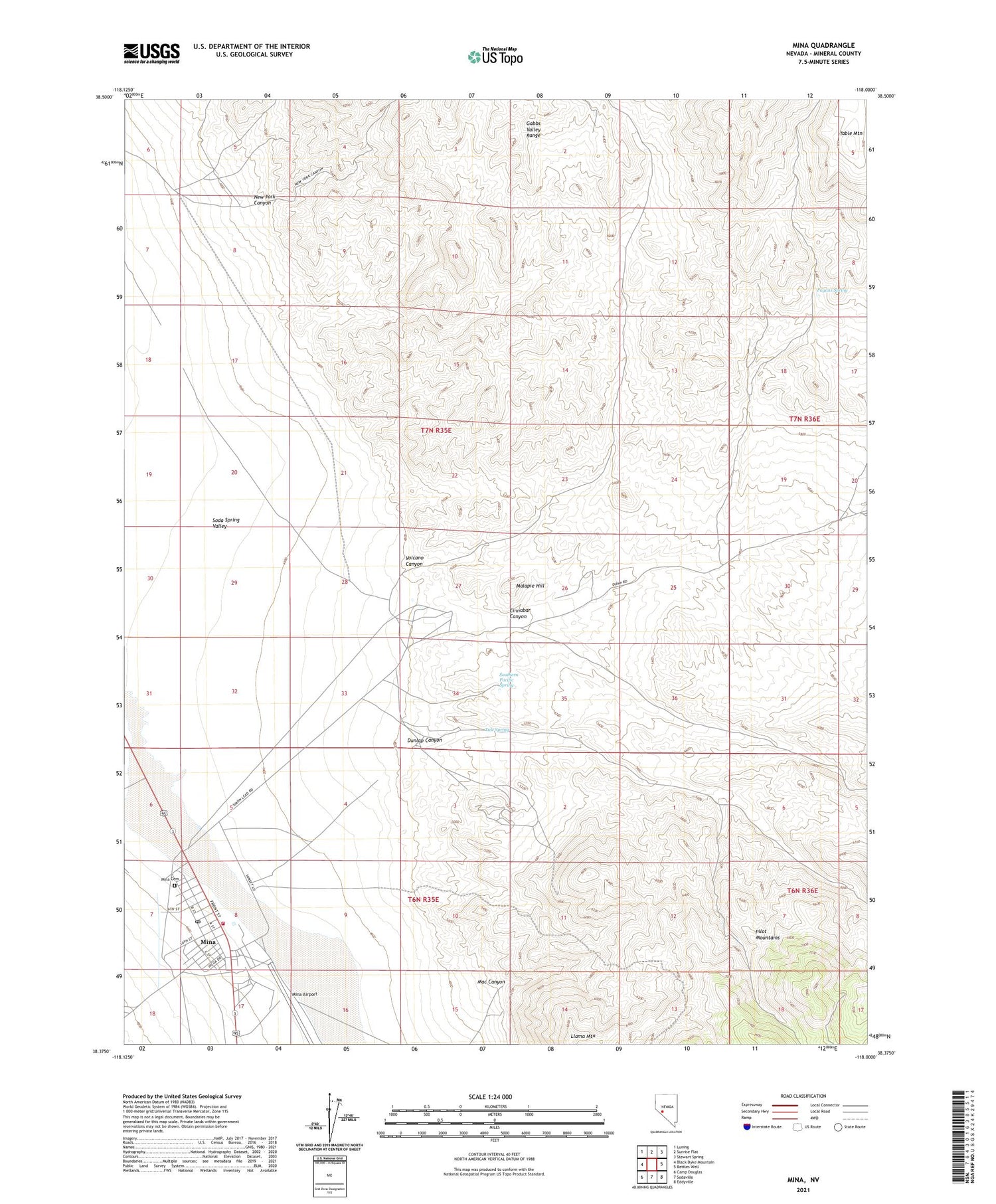
2021 topographic map quadrangle Mina in the state of Nevada. Scale: 1:24000. Based on the newly updated USGS 7.5' US Topo map series, this map is in the following counties: Mineral. The map contains contour data, water features, and other items you are used to seeing on USGS maps, but also has updated roads and other features. This is the next generation of topographic maps. Printed on high-quality waterproof paper with UV fade-resistant inks.
Quads adjacent to this one:
West: Black Dyke Mountain
Northwest: Luning
North: Sunrise Flat
Northeast: Stewart Spring
East: Bettles Well
Southeast: Eddyville
South: Sodaville
Southwest: Camp Douglas
Contains the following named places: Cinnabar Canyon, Dunlap Canyon, Fagans Spring, Llama Mountain, Mac Canyon, Malapie Hill, Mina, Mina Airport, Mina Cemetery, Mina Census Designated Place, Mina Elementary School, Mina Post Office, Mina Volunteer Fire Department, New York Canyon, Nun Mine, Pine Tree Mine, Southern Pacific Spring, Tule Spring, Volcano Canyon