MyTopo
Camp Douglas Nevada US Topo Map
Couldn't load pickup availability
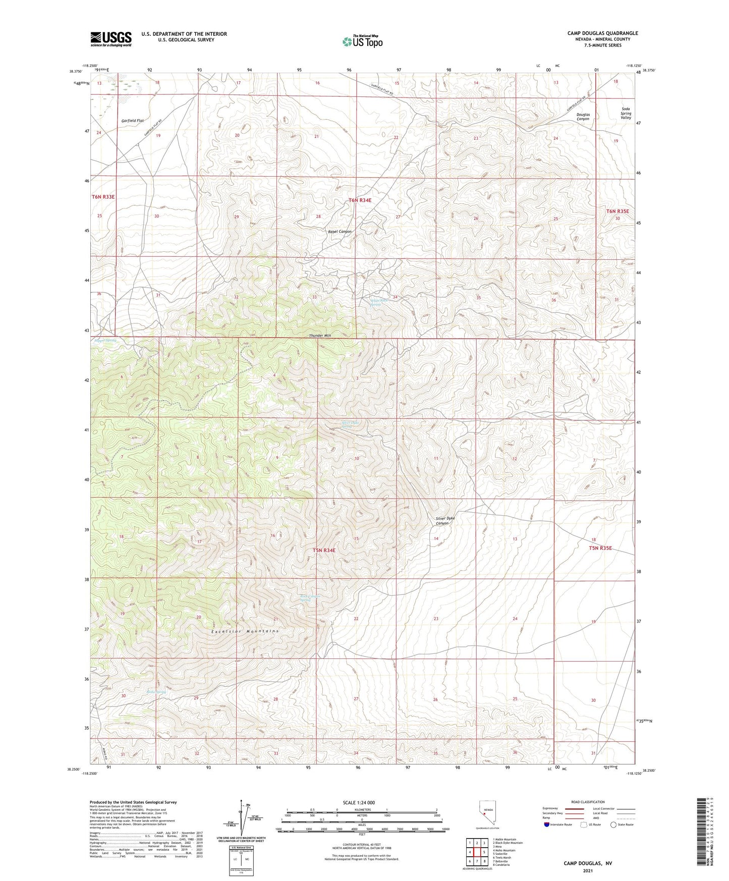
2021 topographic map quadrangle Camp Douglas in the state of Nevada. Scale: 1:24000. Based on the newly updated USGS 7.5' US Topo map series, this map is in the following counties: Mineral. The map contains contour data, water features, and other items you are used to seeing on USGS maps, but also has updated roads and other features. This is the next generation of topographic maps. Printed on high-quality waterproof paper with UV fade-resistant inks.
Quads adjacent to this one:
West: Moho Mountain
Northwest: Mable Mountain
North: Black Dyke Mountain
Northeast: Mina
East: Sodaville
Southeast: Candelaria
South: Belleville
Southwest: Teels Marsh
This map covers the same area as the classic USGS quad with code o38118c2.
Contains the following named places: Ackerman Mine, American Flag Mine, Baker Well, Blue Dump Mine, Bounce Mine, Brown Mine, Camp Douglas, Chief Mine, Dispozitch Mine, Douglas Canyon, Douglas Mine, Douglass Post Office, Fortuna Mine, Fottler Mine, Gem Mine, Goldrange Copper Mine, Grassi Mine, Hardluck Mine, Juniper Mine, Kernick Mine, Little Chief Mine, Mary Mine, Maryann Mine, Mina Division, Mina Township, Moho Spring, New Party Mine, October Mine, One Thousand Nine Hundred Five Mine, Oriole Mine, Orphan Boy Mine, Pepper Mine, Pepper Spring, Rebel Canyon, Rock Canyon Spring, Roosevelt Mine, Silver Dyke Canyon, Silver Dyke Mine, Silver Dyke Spring, Snowball Mine, Sunset Mine, Sunshine Mine, Thunder Mountain, Triumph Mine, Virginia, White Rock Spring