MyTopo
Miners Canyon Nevada US Topo Map
Couldn't load pickup availability
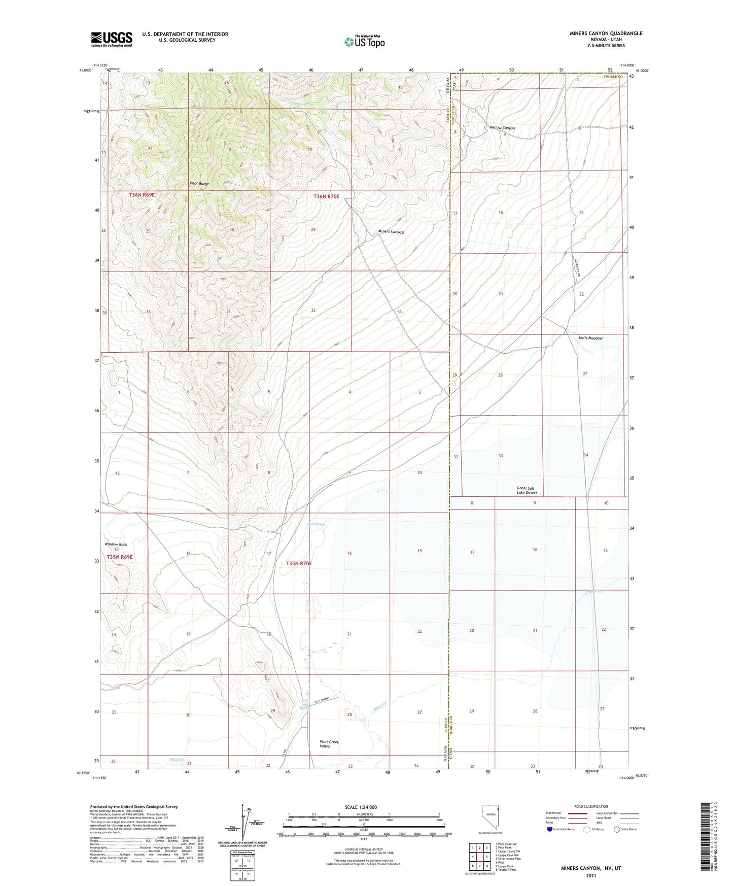
2021 topographic map quadrangle Miners Canyon in the states of Nevada, Utah. Scale: 1:24000. Based on the newly updated USGS 7.5' US Topo map series, this map is in the following counties: Elko, Tooele, Box Elder. The map contains contour data, water features, and other items you are used to seeing on USGS maps, but also has updated roads and other features. This is the next generation of topographic maps. Printed on high-quality waterproof paper with UV fade-resistant inks.
Quads adjacent to this one:
West: Leppy Peak NW
Northwest: Pilot Peak SW
North: Pilot Peak
Northeast: Crater Island SW
East: Silver Island Pass
Southeast: Tetzlaff Peak
South: Leppy Peak
Southwest: Pilot
Contains the following named places: Halls Meadow, Little Salt Spring, Miners Canyon, Miners Spring, Pilot Creek Valley, Salt Spring, Willow Canyon, Window Rock