MyTopo
Misfits Flat Nevada US Topo Map
Couldn't load pickup availability
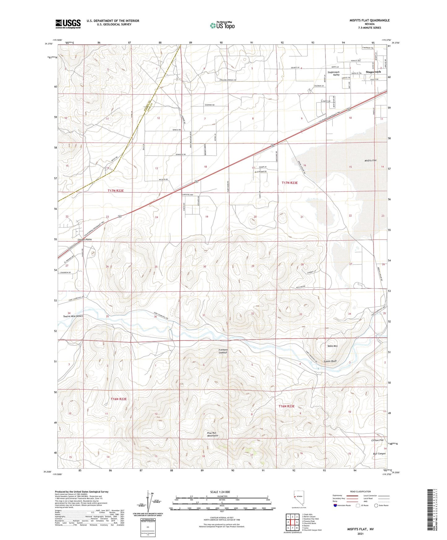
2021 topographic map quadrangle Misfits Flat in the state of Nevada. Scale: 1:24000. Based on the newly updated USGS 7.5' US Topo map series, this map is in the following counties: Lyon, Storey. The map contains contour data, water features, and other items you are used to seeing on USGS maps, but also has updated roads and other features. This is the next generation of topographic maps. Printed on high-quality waterproof paper with UV fade-resistant inks.
Quads adjacent to this one:
West: Flowery Peak
Northwest: Chalk Hills
North: Martin Canyon
Northeast: Stockton Flat Well
East: Churchill Butte
Southeast: Churchill Canyon Well
South: Como
Southwest: Dayton
Contains the following named places: Badger Mining District, Break a Heart Ranch Number 1, Canty, Chaves Ranch, Clifton, Dayton Iron Mine, Desert Station, Fremont Lookout, Gates Station, Haufman, Koch Ditch, Misfits Flat, Pearl Harbor Mine, Red Mountain Mining District, Rosetta Mine, Spur A, Stagecoach Census Designated Place, Stagecoach Valley, Susans Bluff, Table Mountain, Whinn Shaft