MyTopo
Como Nevada US Topo Map
Couldn't load pickup availability
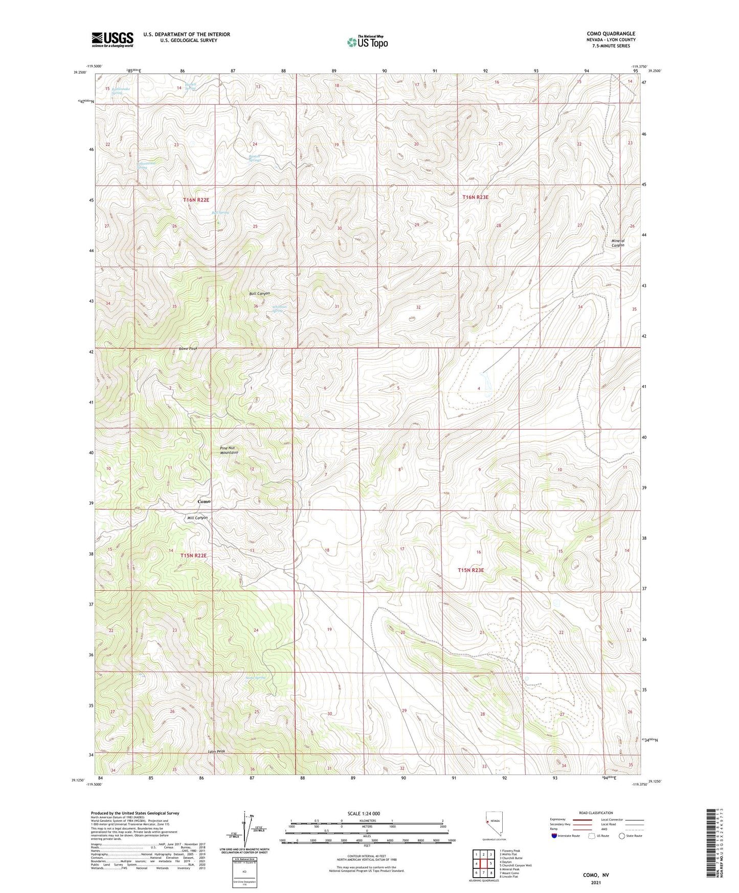
2021 topographic map quadrangle Como in the state of Nevada. Scale: 1:24000. Based on the newly updated USGS 7.5' US Topo map series, this map is in the following counties: Lyon. The map contains contour data, water features, and other items you are used to seeing on USGS maps, but also has updated roads and other features. This is the next generation of topographic maps. Printed on high-quality waterproof paper with UV fade-resistant inks.
Quads adjacent to this one:
West: Dayton
Northwest: Flowery Peak
North: Misfits Flat
Northeast: Churchill Butte
East: Churchill Canyon Well
Southeast: Lincoln Flat
South: Mount Como
Southwest: Mineral Peak
This map covers the same area as the classic USGS quad with code o39119b4.
Contains the following named places: Barton Springs, Boyle Tunnel, Bull Spring, Como, Como Mines, Como Mining District, Como Post Office, Cottonwood Spring, Dayton Division, Hazlett Spring, Hercules Mine, Lyon Peak, May Day Mine, Mohawk Mine, Palmyra, Palmyra Post Office, Pony Meadows Mine, Rattlesnake Spring, Rawe Peak, Stone Cabin, Stone Cabin Mine, Stone Spring, Whitman Coal Mines, Whitman Spring, ZIP Code: 89403