MyTopo
Churchill Butte Nevada US Topo Map
Couldn't load pickup availability
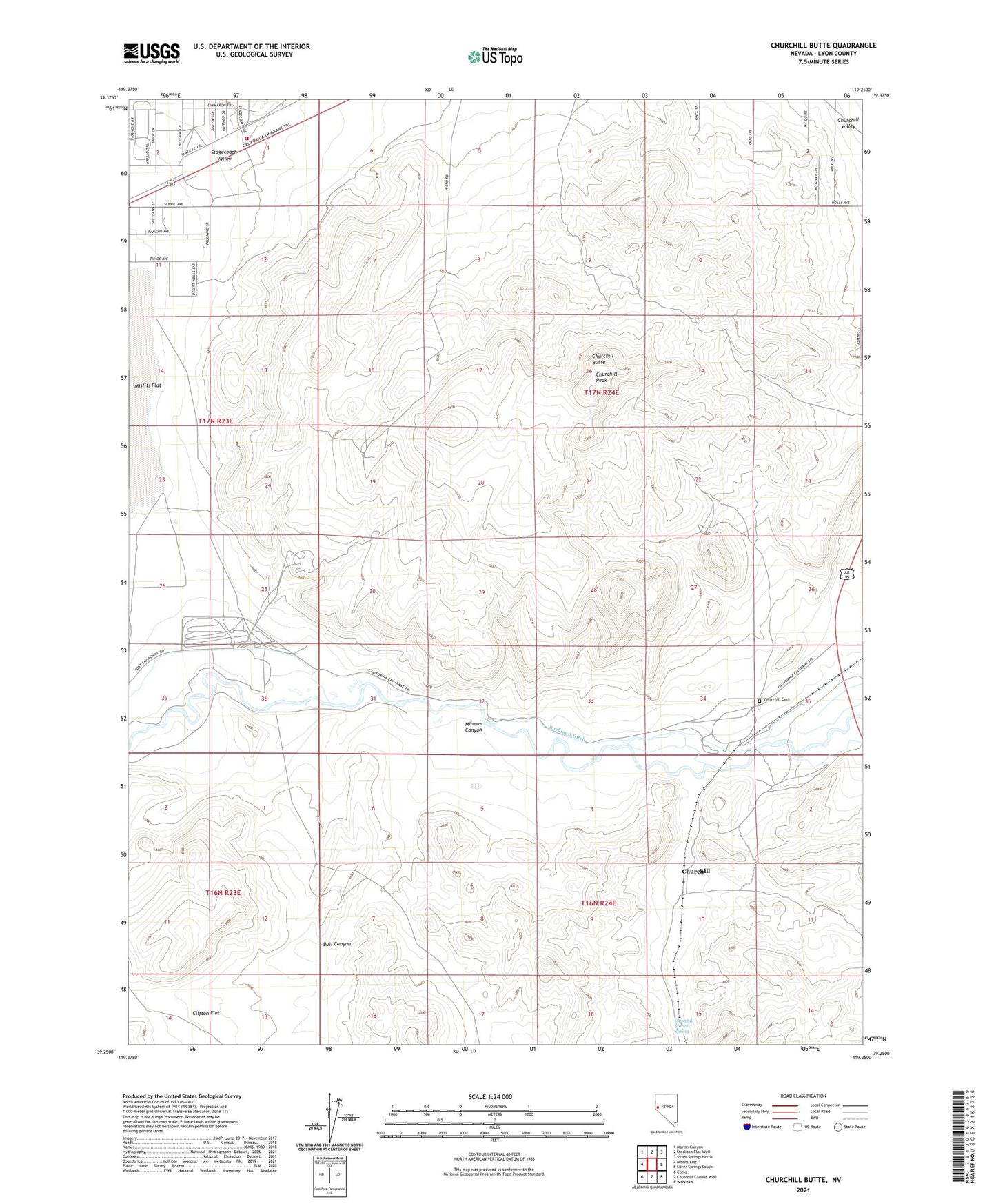
2021 topographic map quadrangle Churchill Butte in the state of Nevada. Scale: 1:24000. Based on the newly updated USGS 7.5' US Topo map series, this map is in the following counties: Lyon. The map contains contour data, water features, and other items you are used to seeing on USGS maps, but also has updated roads and other features. This is the next generation of topographic maps. Printed on high-quality waterproof paper with UV fade-resistant inks.
Quads adjacent to this one:
West: Misfits Flat
Northwest: Martin Canyon
North: Stockton Flat Well
Northeast: Silver Springs North
East: Silver Springs South
Southeast: Wabuska
South: Churchill Canyon Well
Southwest: Como
This map covers the same area as the classic USGS quad with code o39119c3.
Contains the following named places: B H and V Mine, Browns Station, Bucklands Station, Bull Canyon, California Emigrant Trail, Central Lyon County Fire Protection District Stagecoach Volunteer Fire Department Station 37, Churchill, Churchill Butte, Churchill Cemetery, Churchill Mining District, Churchill Peak, Churchill Station Spring, Clifton Flat, Colonel Charles McDermitt Visitor Center Complex, Dayton Township, Fort Churchill Historic State Monument, Fort Churchill Post Office, Fort Churchill Station, Houghman and Howard Ditch, Howard, John C Fremont Picnic Area, Lyon, Mineral Canyon, Old Fort Churchill, Pony Bob Haslam Group Use Area, Pony Express Well, Ruth Mine, Samuel Bucklands Campground, Stagecoach, Stagecoach Christian Academy, Tugela, Weeks, Weeks Post Office, Weeks Toll Ranch, ZIP Code: 89429