MyTopo
Flowery Peak Nevada US Topo Map
Couldn't load pickup availability
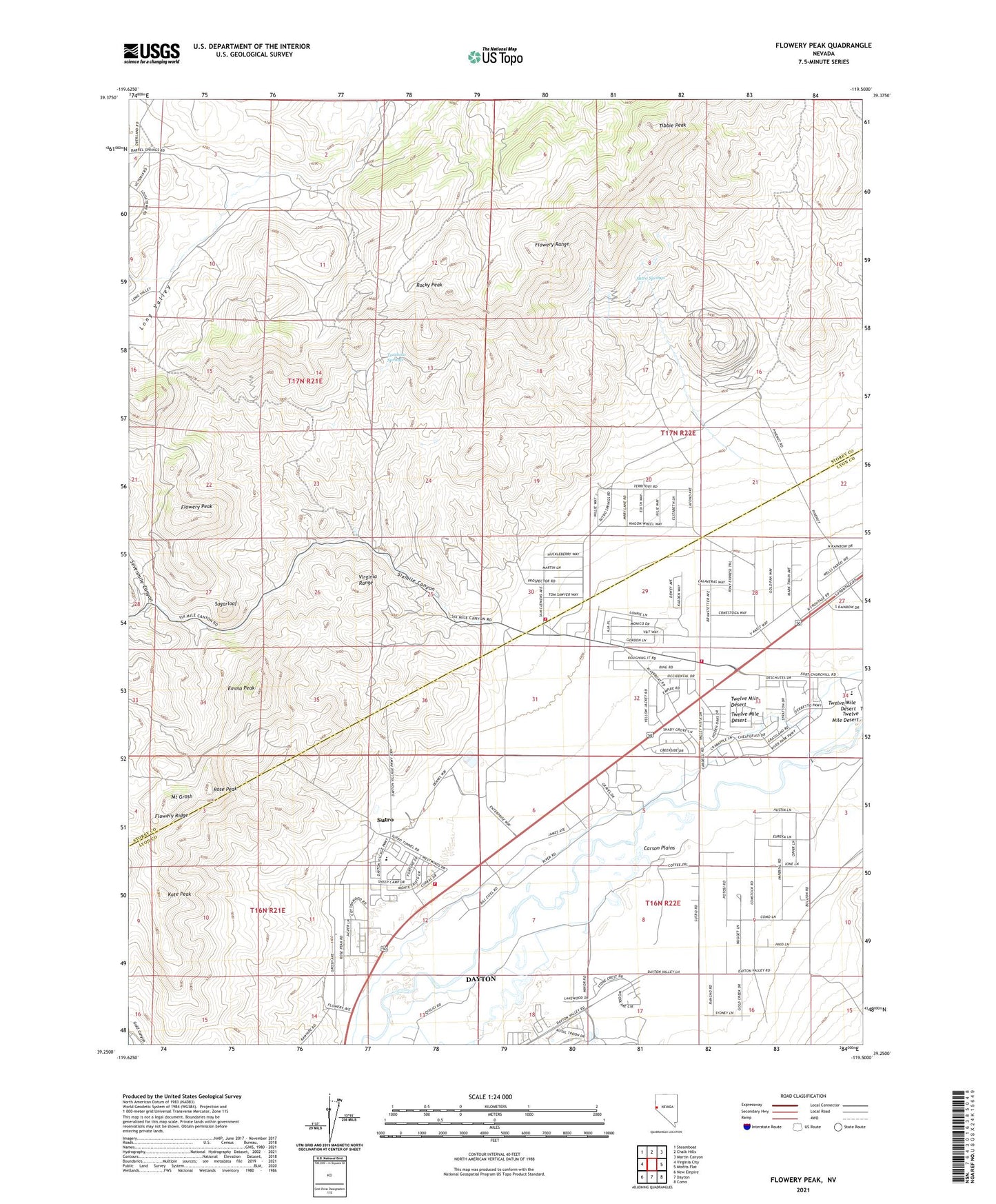
2021 topographic map quadrangle Flowery Peak in the state of Nevada. Scale: 1:24000. Based on the newly updated USGS 7.5' US Topo map series, this map is in the following counties: Storey, Lyon. The map contains contour data, water features, and other items you are used to seeing on USGS maps, but also has updated roads and other features. This is the next generation of topographic maps. Printed on high-quality waterproof paper with UV fade-resistant inks.
Quads adjacent to this one:
West: Virginia City
Northwest: Steamboat
North: Chalk Hills
Northeast: Martin Canyon
East: Misfits Flat
Southeast: Como
South: Dayton
Southwest: New Empire
This map covers the same area as the classic USGS quad with code o39119c5.
Contains the following named places: Bartola Mill, Bassett Mill, Belmont-Uncle Sam Shaft, Berry Glory Hole, Bossells Mill, Butters Mill, Carson Plains, Carson Rapids City, Carson Valley Mill, Centennial Mill, Central Lyon County Fire Protection District Mark Twain Volunteer Fire Department Station 38, Central Lyon County Fire Protection District Sutro Fire Department Station 35, Dayton Census Designated Place, Desert Mill, Emma Peak, Empire State Mill, Fisher Mill, Flowery City, Flowery Mill, Flowery Mine, Flowery Mining District, Flowery Peak, Flowery Ridge, Freeborn and Sheldons Mill, Frink Mill, Frothingham and Company Mill, Gautiers Mill, Gee Ditch, Gould and Curry Mill, Heidenrick and Miner Ranch, Janin and Parke Mill, Jennings Mill, Johntown, Jolly Giant Mill, Kate Peak, Lady Bryan Mill, Lady Bryan Mine, Leversy Station, Long Valley, Mark Twain Estates, Monte Cristo, Monte Cristo Mine, Mount Grosh, Natural Life Mine, North Bonanza Mine, Olive Branch Mill, Quilici Ranch, Randall, Red Lodge Hunting Club, Reeds Station, Rocky Peak, Rogers Mill, Rose Peak, Sevenmile Canyon, Sixmile Canyon, Steen Ranch, Storey County Fire Department Station 3 Mark Twain, Succor Mill, Sugarloaf, Sugarloaf Mill, Sutro, Sutro Elementary School, Sutro Post Office, Sutro Springs, Sutro Tunnel, The Express Mill, Tibbie Peak, Tocchino Springs, Twelve Mile Desert, Upper Cardelli Ditch, Utah Mill, Virginia Creek