MyTopo
Moho Mountain Nevada US Topo Map
Couldn't load pickup availability
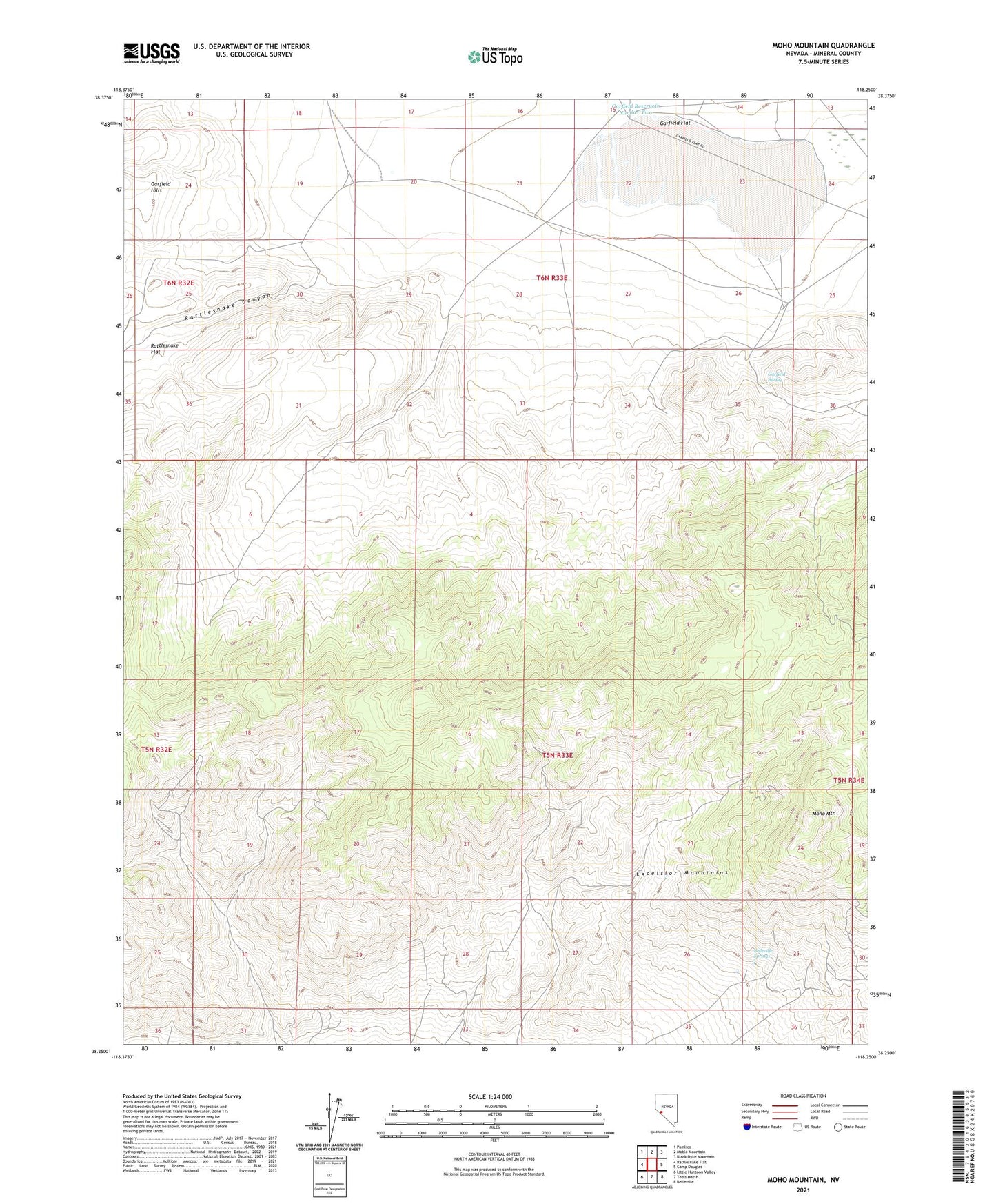
2021 topographic map quadrangle Moho Mountain in the state of Nevada. Scale: 1:24000. Based on the newly updated USGS 7.5' US Topo map series, this map is in the following counties: Mineral. The map contains contour data, water features, and other items you are used to seeing on USGS maps, but also has updated roads and other features. This is the next generation of topographic maps. Printed on high-quality waterproof paper with UV fade-resistant inks.
Quads adjacent to this one:
West: Rattlesnake Flat
Northwest: Pamlico
North: Mable Mountain
Northeast: Black Dyke Mountain
East: Camp Douglas
Southeast: Belleville
South: Teels Marsh
Southwest: Little Huntoon Valley
Contains the following named places: Badger Mine, Belleville Springs, Birdsong Mine, Black Hawk Mine, Combination Mining Company Mine, Endowment Mine, Excelsior Mountains, Federal Mining and Engineering Company Mill, Garfield Flat, Garfield Mill, Garfield Reservoir Number One, Garfield Reservoir Number Two, Garfield Spring, Marietta Mines, Moho, Moho Mine, Moho Mountain, Rattlesnake Canyon, Rip Van Winkle Mine, Rutty Mine, San Francisco Bell Mine, Silver Gulch Mine, Silver Star Mining District