MyTopo
Moses Rock Nevada US Topo Map
Couldn't load pickup availability
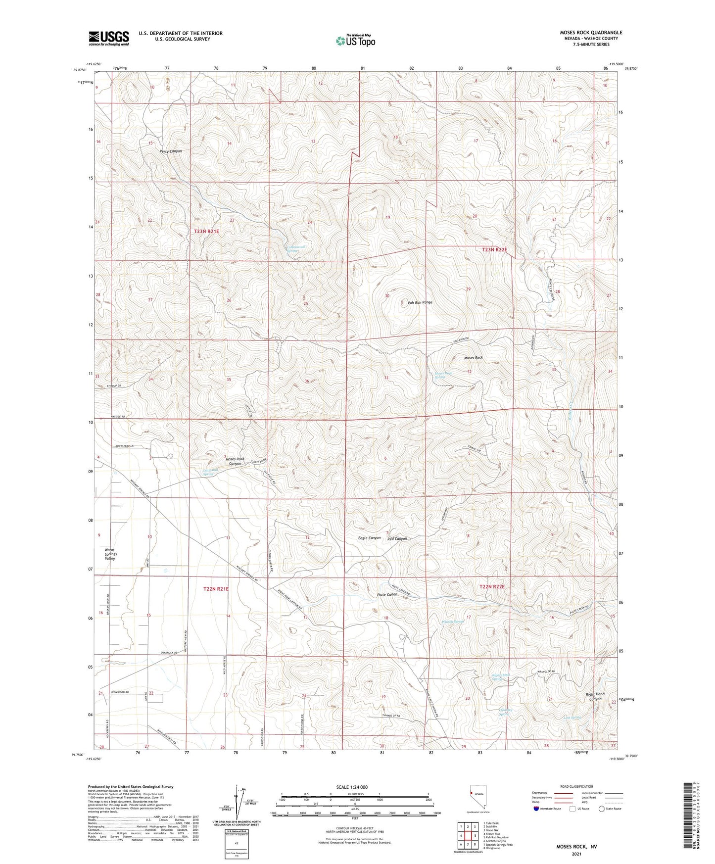
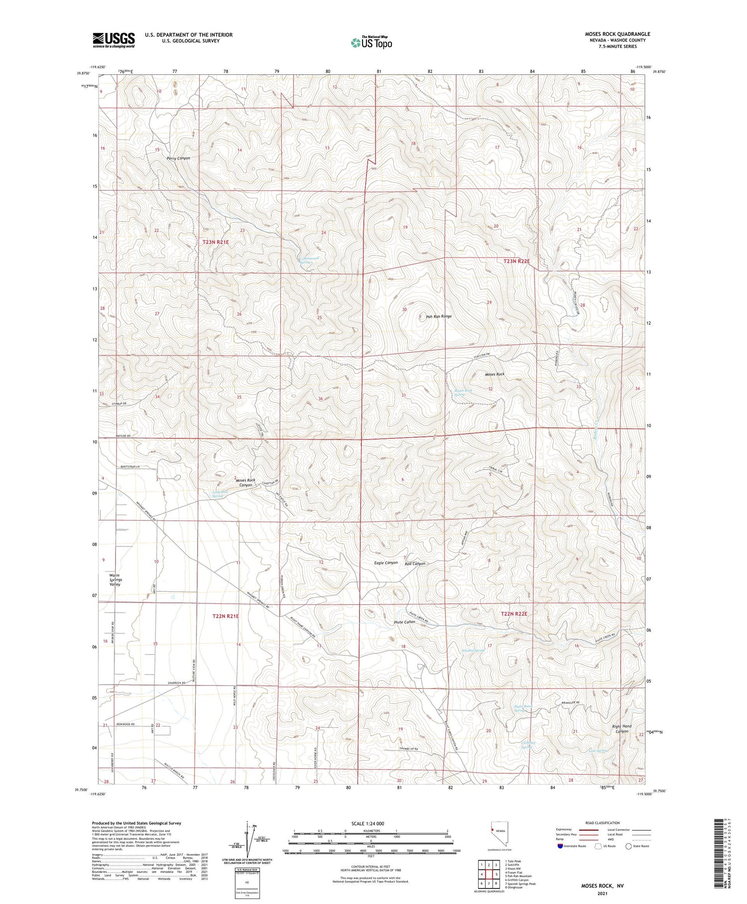
2021 topographic map quadrangle Moses Rock in the state of Nevada. Scale: 1:24000. Based on the newly updated USGS 7.5' US Topo map series, this map is in the following counties: Washoe. The map contains contour data, water features, and other items you are used to seeing on USGS maps, but also has updated roads and other features. This is the next generation of topographic maps. Printed on high-quality waterproof paper with UV fade-resistant inks.
Quads adjacent to this one:
West: Fraser Flat
Northwest: Tule Peak
North: Sutcliffe
Northeast: Nixon NW
East: Pah Rah Mountain
Southeast: Olinghouse
South: Spanish Springs Peak
Southwest: Griffith Canyon
Contains the following named places: Auburn Mine, Buckeye Mine, Cambell Mine, Chimney Spring, Cinch Mine, Cottonwood Spring, Crown Prince Mine, Eagle Canyon, Gamble Mine, Gregory Mine, Infant Mine, Jones Kincaid Mine, Justover Field, Little Bull Spring, Lost Spring, Monarch Mine, Monte Cristo Ranch, Moses Rock, Moses Rock Canyon, Moses Rock Spring, Nevada Dominion Mine, Pacific Pyramid Mine, Paiute Creek, Perry Canyon, Piute Canon, Pyramid, Pyramid Mines, Pyramid Mining District, Pyramid Post Office, Red Canyon, Right Hand Spring, Upper Pyramid, Venetion Mine, Wadsworth Township, Walker Mine, Warm Springs Valley, Whisky Spring