MyTopo
Pah Rah Mountain Nevada US Topo Map
Couldn't load pickup availability
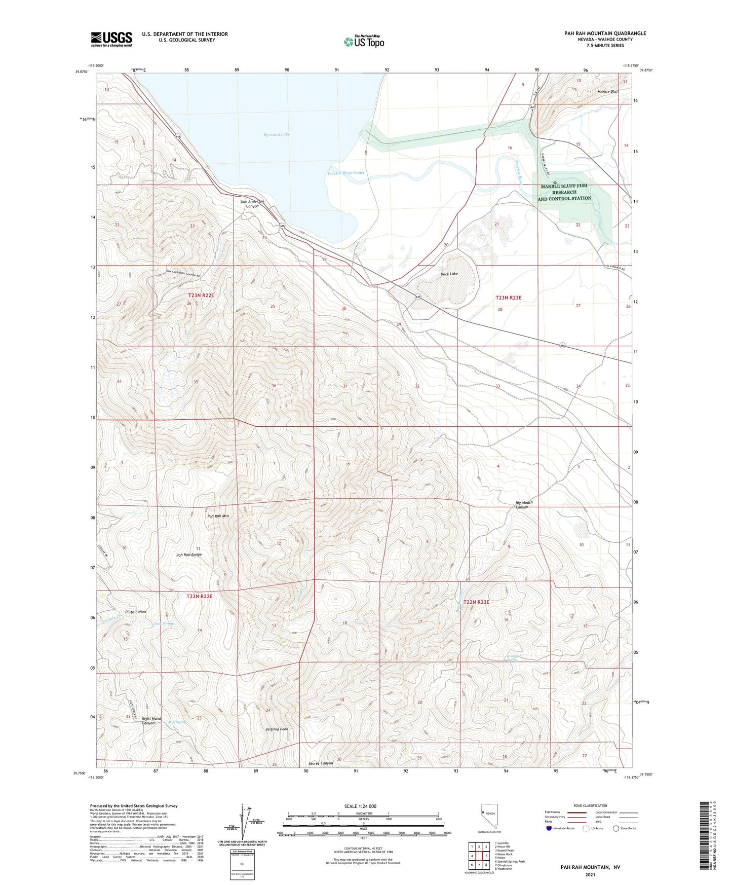
2021 topographic map quadrangle Pah Rah Mountain in the state of Nevada. Scale: 1:24000. Based on the newly updated USGS 7.5' US Topo map series, this map is in the following counties: Washoe. The map contains contour data, water features, and other items you are used to seeing on USGS maps, but also has updated roads and other features. This is the next generation of topographic maps. Printed on high-quality waterproof paper with UV fade-resistant inks.
Quads adjacent to this one:
West: Moses Rock
Northwest: Sutcliffe
North: Nixon NW
Northeast: Russell Peak
East: Nixon
Southeast: Wadsworth
South: Olinghouse
Southwest: Spanish Springs Peak
This map covers the same area as the classic USGS quad with code o39119g4.
Contains the following named places: Big Mouth Canyon, Big Mouth Creek, Big Mouth Mine, Branch Big Mouth Creek, Coal Creek, Duck Lake, Fort Haven, Guanomi Mine, Heslip, Libby, Marble Bluff, Marble Bluff Dam, Marble Bluff Fish Research and Control Station, Mud Lake Slough, Mud Spring, Pah Rah Mountain, Pyramid Lake Fishway, Rosebush Spring, Tom Anderson Canyon, Truckee River, Truckee River Outlet, Twin Springs, Virginia Peak