MyTopo
Sutcliffe Nevada US Topo Map
Couldn't load pickup availability
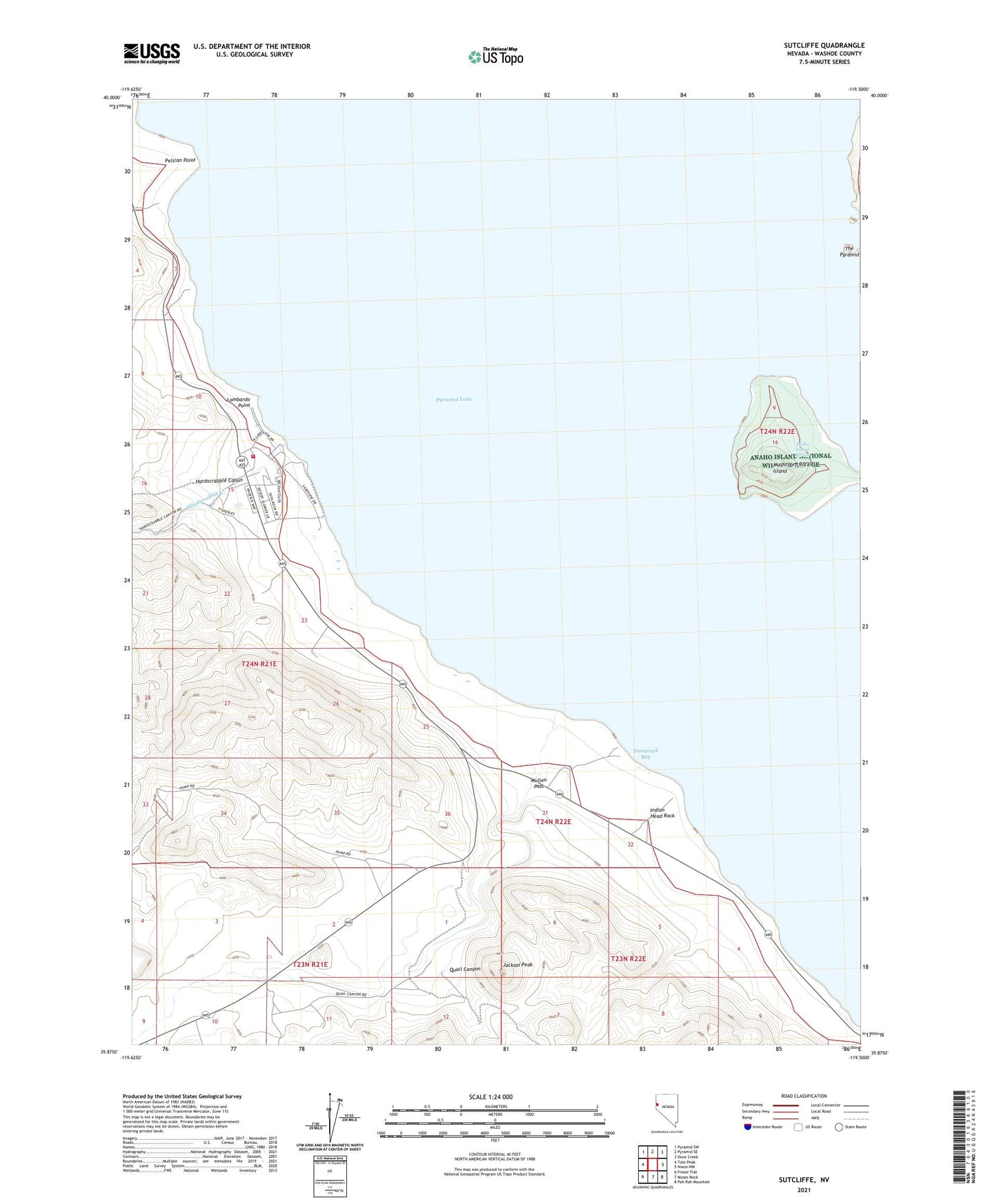
2021 topographic map quadrangle Sutcliffe in the state of Nevada. Scale: 1:24000. Based on the newly updated USGS 7.5' US Topo map series, this map is in the following counties: Washoe. The map contains contour data, water features, and other items you are used to seeing on USGS maps, but also has updated roads and other features. This is the next generation of topographic maps. Printed on high-quality waterproof paper with UV fade-resistant inks.
Quads adjacent to this one:
West: Tule Peak
Northwest: Pyramid SW
North: Pyramid SE
Northeast: Dove Creek
East: Nixon NW
Southeast: Pah Rah Mountain
South: Moses Rock
Southwest: Fraser Flat
This map covers the same area as the classic USGS quad with code o39119h5.
Contains the following named places: Anaho Island, Anaho Island National Wildlife Refuge, Anaho Island Spring, Dewey, Dewey Post Office, Hardscrabble Canon, Hardscrabble Creek, Heply Post Office, Indian Head Rock, Jackass Peak, Lombardo Point, Mullen Creek, Mullen Pass, Mushroom Rock, Pelican Point, Pyramid Island Hot Spring, Quail Canyon, Quail Canyon Ranch, Romolo, Sutcliffe, Sutcliffe Post Office, Sutcliffe School, Sutcliffe Volunteer Fire Department Station 241, Tamarack Bay, The Pyramid