MyTopo
Olinghouse Nevada US Topo Map
Couldn't load pickup availability
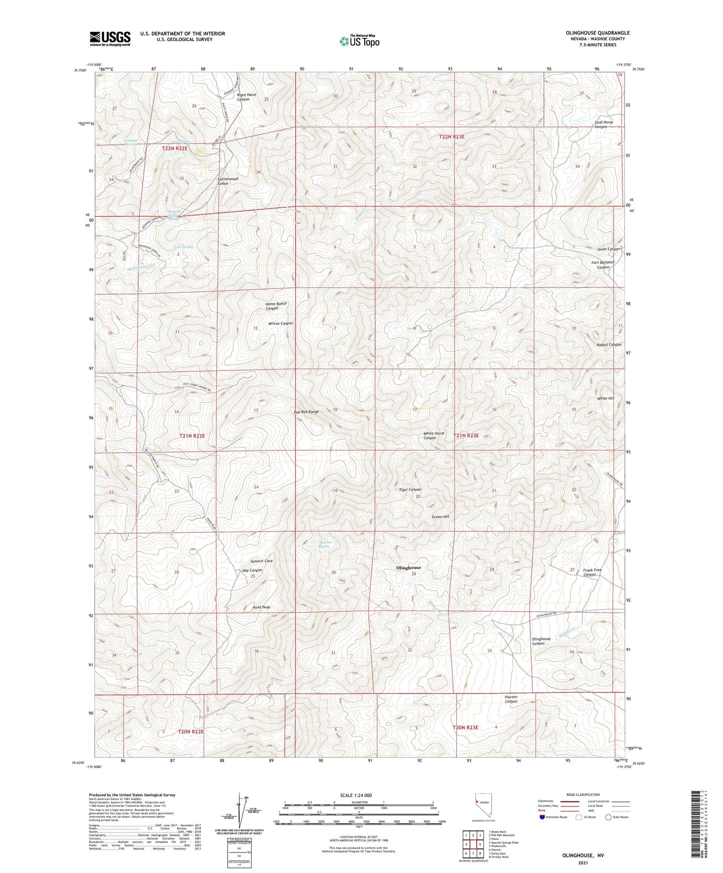
2021 topographic map quadrangle Olinghouse in the state of Nevada. Scale: 1:24000. Based on the newly updated USGS 7.5' US Topo map series, this map is in the following counties: Washoe. The map contains contour data, water features, and other items you are used to seeing on USGS maps, but also has updated roads and other features. This is the next generation of topographic maps. Printed on high-quality waterproof paper with UV fade-resistant inks.
Quads adjacent to this one:
West: Spanish Springs Peak
Northwest: Moses Rock
North: Pah Rah Mountain
Northeast: Nixon
East: Wadsworth
Southeast: Fernley West
South: Derby Dam
Southwest: Patrick
This map covers the same area as the classic USGS quad with code o39119f4.
Contains the following named places: Buster Mine, Dondero Mill, Dondero Shaft, Fort Defiance, Fort Defiance Canyon, Frank Free Canyon, Green Hill, Green Mountain Mines, Jackass Spring, Jones Canyon, Jones Canyon Ranch, Jones Creek, Keystone Nevada Mine, KZSR-FM (Reno), Olinghouse, Olinghouse Canyon, Olinghouse Mill, Olinghouse Mine, Olinghouse Mining District, Olinghouse Post Ofice, Ora, Ora Post Office, Pah Rah Range, Pierson Canyon, Pond Peak, Quaking Aspen Spring, Rabbit Canyon, Sand Spring, Sheehan Spring, Slip Mill, Stud Horse Canyon, Summit Cave, Tiger Group Mine, Twin Springs, White Hill, ZIP Code: 89442