MyTopo
Mosey Mountain Nevada US Topo Map
Couldn't load pickup availability
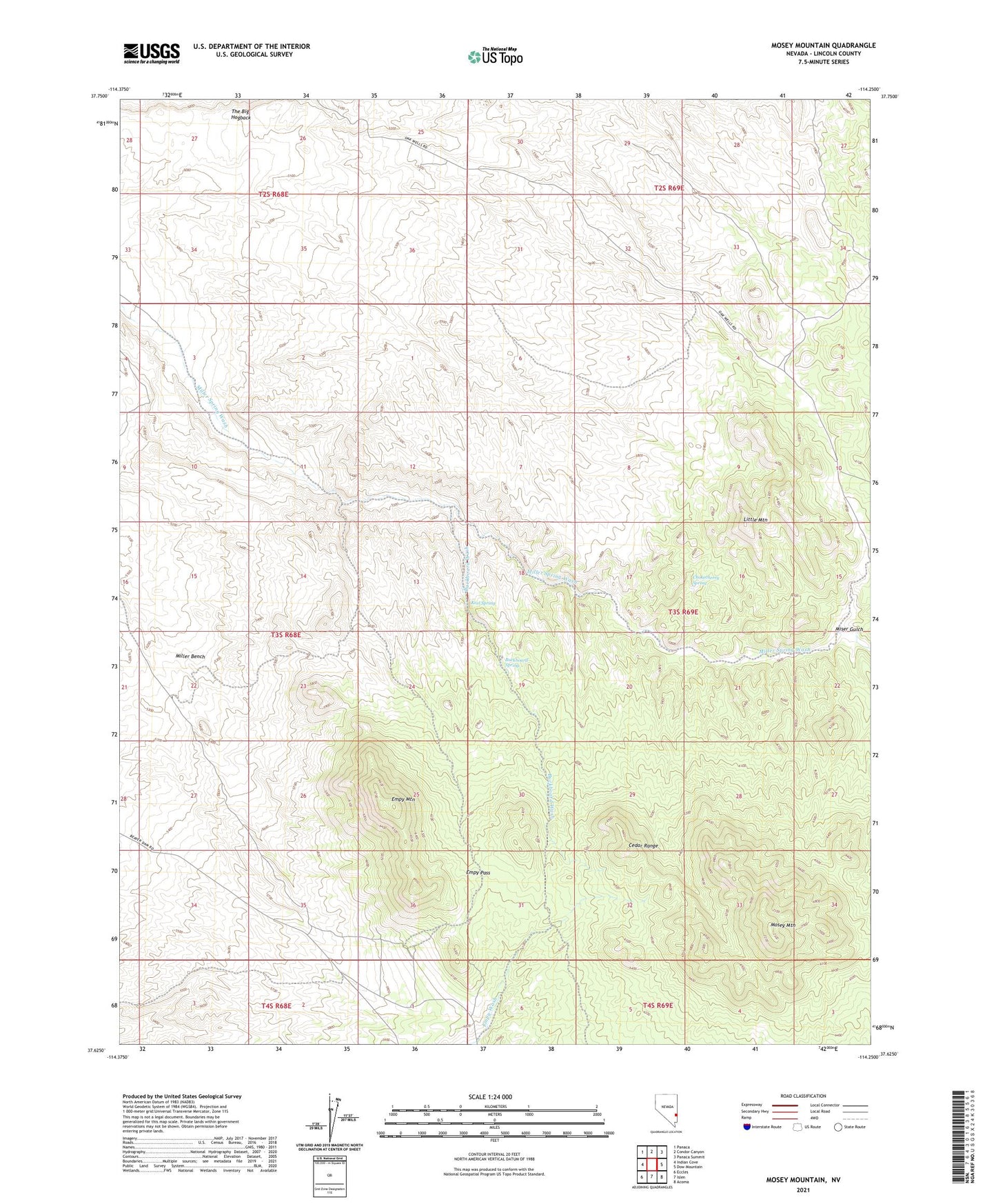
2021 topographic map quadrangle Mosey Mountain in the state of Nevada. Scale: 1:24000. Based on the newly updated USGS 7.5' US Topo map series, this map is in the following counties: Lincoln. The map contains contour data, water features, and other items you are used to seeing on USGS maps, but also has updated roads and other features. This is the next generation of topographic maps. Printed on high-quality waterproof paper with UV fade-resistant inks.
Quads adjacent to this one:
West: Indian Cove
Northwest: Panaca
North: Condor Canyon
Northeast: Panaca Summit
East: Dow Mountain
Southeast: Acoma
South: Islen
Southwest: Eccles
This map covers the same area as the classic USGS quad with code o37114f3.
Contains the following named places: Aztec Mine, Buckboard Spring, Buckboard Wash, Cedar Range, Chokecherry Spring, Empy Mountain, Empy Pass, Keel Spring, Little Mountain, Little Mountain Mining District, Miser Gulch, Mosey Mountain, Rabbit Spring, The Big Hogback, ZIP Code: 89042