MyTopo
Panaca Summit Nevada US Topo Map
Couldn't load pickup availability
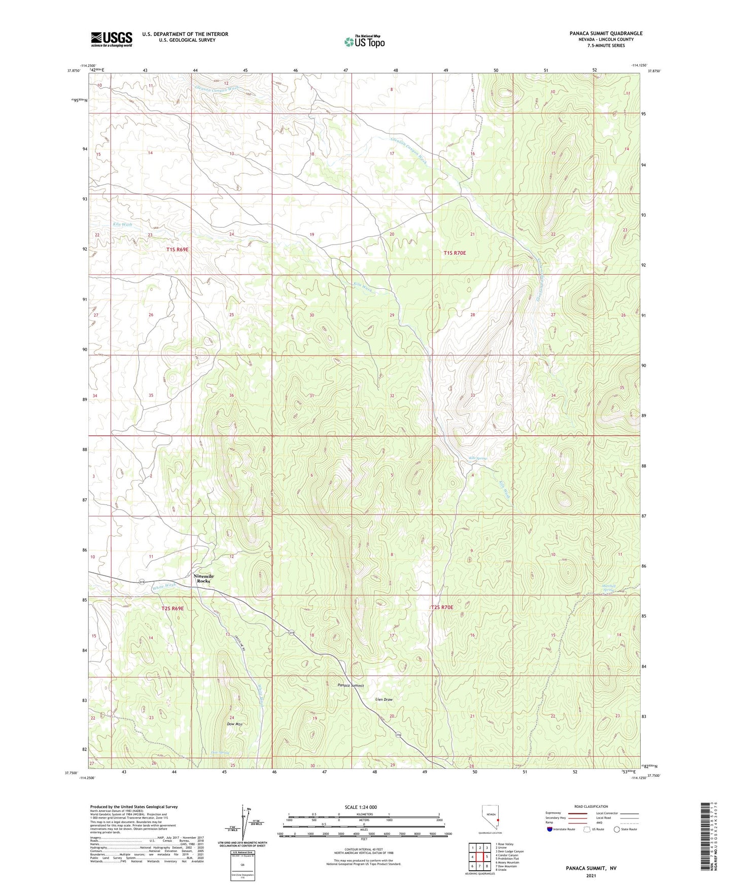
2021 topographic map quadrangle Panaca Summit in the state of Nevada. Scale: 1:24000. Based on the newly updated USGS 7.5' US Topo map series, this map is in the following counties: Lincoln. The map contains contour data, water features, and other items you are used to seeing on USGS maps, but also has updated roads and other features. This is the next generation of topographic maps. Printed on high-quality waterproof paper with UV fade-resistant inks.
Quads adjacent to this one:
West: Condor Canyon
Northwest: Rose Valley
North: Ursine
Northeast: Deer Lodge Canyon
East: Prohibition Flat
Southeast: Uvada
South: Dow Mountain
Southwest: Mosey Mountain
This map covers the same area as the classic USGS quad with code o37114g2.
Contains the following named places: Dow Spring, Kiln Spring, Marchell Spring, Ninemile Rocks, Panaca Summit