
MyTopo
Mound Spring Nevada US Topo Map
Couldn't load pickup availability
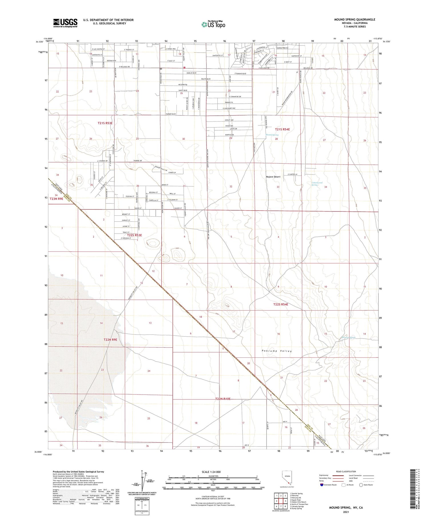
2021 topographic map quadrangle Mound Spring in the state of Nevada. Scale: 1:24000. Based on the newly updated USGS 7.5' US Topo map series, this map is in the following counties: Nye, Inyo. The map contains contour data, water features, and other items you are used to seeing on USGS maps, but also has updated roads and other features. This is the next generation of topographic maps. Printed on high-quality waterproof paper with UV fade-resistant inks.
Quads adjacent to this one:
West: Nopah Peak
Northwest: Sixmile Spring
North: Pahrump
Northeast: Pahrump NE
East: Hidden Hills Ranch
Southeast: Stump Spring
South: Calvada Springs
Southwest: North of Tecopa Pass
Contains the following named places: Browns Spring, Chicken Ranch Airport, Cottonwood Spring, Hafen Elementary School, Homestead Post Office, Mound Spring, Pahrump Valley Fire and Rescue Station 3, Ward Ranch, ZIP Code: 89061


